Directions to Trosa with public transportation
The following transit lines have routes that pass near Trosa
How to get to Trosa by bus?
Click on the bus route to see step by step directions with maps, line arrival times and updated time schedules.
Bus stops near Trosa
- Teologen, 1 min walk,
- Verktygsgatan, 4 min walk,
- Stensundsvägen, 6 min walk,
- Trosa Centrum, 14 min walk,
Bus lines to Trosa
- 551, Trosa Hamn,
- 553, Västerljung Erikslundsvägen,
- 605, Nyköping Busstation,
- 550, Trosa Hamn,
- 554, Nyköping Gripenskolan,
- 710, Trosa Hamn,
- 802, Södertälje Centrum Västra,
- 805, Nyköping Busstation,
- 556, Vagnhärad Station,
- TROSABUSSEN, Trosa Hamn,
What are the closest stations to Trosa?
The closest stations to Trosa are:
- Teologen is 62 meters away, 1 min walk.
- Verktygsgatan is 296 meters away, 4 min walk.
- Stensundsvägen is 447 meters away, 6 min walk.
- Trosa Centrum is 1031 meters away, 14 min walk.
Which bus lines stop near Trosa?
These bus lines stop near Trosa: 551, 802.
What’s the nearest bus stop to Trosa?
The nearest bus stop to Trosa is Teologen. It’s a 1 min walk away.
What time is the first bus to Trosa?
The 802 is the first bus that goes to Trosa. It stops nearby at 6:30 AM.
What time is the last bus to Trosa?
The 802 is the last bus that goes to Trosa. It stops nearby at 10:56 PM.
How much is the bus fare to Trosa?
The bus fare to Trosa costs about kr35.00 - kr105.00.
How much is the train fare to Trosa?
The train fare to Trosa costs about kr39.00 - kr117.00.
See Trosa on the map
Public Transportation to Trosa
Wondering how to get to Trosa, Sweden? Moovit helps you find the best way to get to Trosa with step-by-step directions from the nearest public transit station.
Moovit provides free maps and live directions to help you navigate through your city. View schedules, routes, timetables, and find out how long does it take to get to Trosa in real time.
Looking for the nearest stop or station to Trosa? Check out this list of stops closest to your destination: Teologen; Verktygsgatan; Stensundsvägen; Trosa Centrum.
Bus: 551, 802, 553, 605, 550, 554, 710, 805, 556, TROSABUSSEN.
Want to see if there’s another route that gets you there at an earlier time? Moovit helps you find alternative routes or times. Get directions from and directions to Trosa easily from the Moovit App or Website.
We make riding to Trosa easy, which is why over 1.5 million users, including users in Trosa, trust Moovit as the best app for public transit. You don’t need to download an individual bus app or train app, Moovit is your all-in-one transit app that helps you find the best bus time or train time available.
For information on prices of bus and train, costs and ride fares to Trosa, please check the Moovit app.
Use the app to navigate to popular places including to the airport, hospital, stadium, grocery store, mall, coffee shop, school, college, and university.
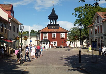
Trosa Address: Södermanlands län street in Trosa
Attractions near Trosa
Trosa Natur Design,Trosa Elektriska Installations,X-Et Project,Ingela Larsen Kommunikation,Trobo,Ketas Bed & Breakfast,Trosalund,Blomstrande Arstid,Lindmans Snickeri och Fastighetsservice,Trosa Anverk,L Nyman VVS,WESTERN UNION,La Piazza,Södertörns Förlag Kalenderspecialisten,Hagafriskvård,Trosa Vårdcentral,Smart Hälsa Lifestyle,Beauty by Venus,Elektroväst G Hagerum,Fastighetsbolaget Trosa Ågubben 6How to get to popular attractions in Trosa with public transit
Friskvårdsvägen 1, Stockholm,Tåg Sala - Avesta Krylbo, Sala,Hantverkargatan, Stockholm,Norra Kapellet, Solna,Saltsjö-Boo, Nacka,Villa Källhagen, Stockholm,Karolinska Universitetssjukhuset Solna, Solna,Sveavägen, Stockholm,Valhallavägen, Stockholm,Sundbybergs Station (B), Sundbyberg,Botkyrka Kommun, Botkyrka,Flygbussarna Brommaplan, Stockholm,Läkarhuset Odenplan, Stockholm,Silverlinjen till Öland, Stockholm,Stadsgården, Tegelvikshamn, Stockholm,Courtyard by Marriott Stockholm Kungsholmen, Stockholm,Hammarby Sjöstad, Stockholm,Sparreholm, Flen,Buss 43, Stockholm,Hamnplan, NyköpingGet around Stockholm by public transit!
Traveling around Stockholm has never been so easy. See step by step directions as you travel to any attraction, street or major public transit station. View bus and train schedules, arrival times, service alerts and detailed routes on a map, so you know exactly how to get to anywhere in Stockholm.
When traveling to any destination around Stockholm use Moovit's Live Directions with Get Off Notifications to know exactly where and how far to walk, how long to wait for your line, and how many stops are left. Moovit will alert you when it's time to get off — no need to constantly re-check whether yours is the next stop.
Wondering how to use public transit in Stockholm or how to pay for public transit in Stockholm? Moovit public transit app can help you navigate your way with public transit easily, and at minimum cost. It includes public transit fees, ticket prices, and costs. Looking for a map of Stockholm public transit lines? Moovit public transit app shows all public transit maps in Stockholm with all Bus, Train, Metro, Light Rail, Ferry and Cable Car routes and stops on an interactive map.
Stockholm has 6 transit type(s), including: Bus, Train, Metro, Light Rail, Ferry and Cable Car, operated by several transit agencies, including SL Tunnelbana, SL Spårvagn, SL Lokalbana, SL Rail, UL, Flygbussarna, Sörmlandstrafiken, X-trafik, Region Gotland, VL, Trosabussen, Vy Bus4You, Bergkvarabuss, Silverlinjen, Y-buss