Directions to Spånga by (Stockholm) with public transportation
The following transit lines have routes that pass near Spånga by
How to get to Spånga by by bus?
Click on the bus route to see step by step directions with maps, line arrival times and updated time schedules.
How to get to Spånga by by metro?
Click on the metro route to see step by step directions with maps, line arrival times and updated time schedules.
Bus stops near Spånga by in Stockholm
- Sotingeplan, 5 min walk,
- Enbacksskolan, 6 min walk,
- Tensta Centrum, 6 min walk,
Metro stations near Spånga by in Stockholm
- Tensta T-Bana, 10 min walk,
- Tensta, 10 min walk,
Bus lines to Spånga by in Stockholm
- 179, Sollentuna Station,
- 179, Vällingby,
- 514, Sollentuna Station,
- 540, Universitetet,
- 514, Spånga Station,
- 196, Hjulsta,
- 540, Tensta Centrum,
- 196, Västra Skogen,
What are the closest stations to Spånga by?
The closest stations to Spånga by are:
- Sotingeplan is 327 meters away, 5 min walk.
- Enbacksskolan is 398 meters away, 6 min walk.
- Tensta Centrum is 434 meters away, 6 min walk.
- Tensta T-Bana is 693 meters away, 10 min walk.
- Tensta is 702 meters away, 10 min walk.
Which bus lines stop near Spånga by?
These bus lines stop near Spånga by: 179, 512, 540.
Which metro line stops near Spånga by?
10
What’s the nearest metro station to Spånga by in Stockholm?
The nearest metro stations to Spånga by in Stockholm are Tensta T-Bana and Tensta. The closest one is a 10 min walk away.
What’s the nearest bus stop to Spånga by in Stockholm?
The nearest bus stop to Spånga by in Stockholm is Sotingeplan. It’s a 5 min walk away.
What time is the first metro to Spånga by in Stockholm?
The 10 is the first metro that goes to Spånga by in Stockholm. It stops nearby at 5:03 AM.
What time is the last metro to Spånga by in Stockholm?
The 10 is the last metro that goes to Spånga by in Stockholm. It stops nearby at 1:13 AM.
What time is the first bus to Spånga by in Stockholm?
The 196 is the first bus that goes to Spånga by in Stockholm. It stops nearby at 3:23 AM.
What time is the last bus to Spånga by in Stockholm?
The 196 is the last bus that goes to Spånga by in Stockholm. It stops nearby at 3:25 AM.
How much is the bus fare to Spånga by?
The bus fare to Spånga by costs about kr39.00.
How much is the light rail fare to Spånga by?
The light rail fare to Spånga by costs about kr39.00.
How much is the train fare to Spånga by?
The train fare to Spånga by costs about kr39.00.
See Spånga by, Stockholm, on the map
Public Transit to Spånga by in Stockholm
Wondering how to get to Spånga by in Stockholm, Sweden? Moovit helps you find the best way to get to Spånga by with step-by-step directions from the nearest public transit station.
Moovit provides free maps and live directions to help you navigate through your city. View schedules, routes, timetables, and find out how long does it take to get to Spånga by in real time.
Looking for the nearest stop or station to Spånga by? Check out this list of stops closest to your destination: Sotingeplan; Enbacksskolan; Tensta Centrum; Tensta T-Bana; Tensta.
Bus: 179, 512, 540, 514.Metro: 10.
Want to see if there’s another route that gets you there at an earlier time? Moovit helps you find alternative routes or times. Get directions from and directions to Spånga by easily from the Moovit App or Website.
We make riding to Spånga by easy, which is why over 1.5 million users, including users in Stockholm, trust Moovit as the best app for public transit. You don’t need to download an individual bus app or train app, Moovit is your all-in-one transit app that helps you find the best bus time or train time available.
For information on prices of bus, metro, light rail and train, costs and ride fares to Spånga by, please check the Moovit app.
Use the app to navigate to popular places including to the airport, hospital, stadium, grocery store, mall, coffee shop, school, college, and university.
Spånga by Address: Holmingegränd street in Stockholm
Attractions near Spånga by
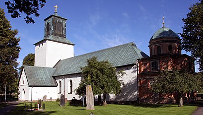
Stockholms kommun,Jc Miljöstäd,Omar Soufi,Pong Sushi Bar,Myway Gardet,Spånga socken,Spånga Kyrka,Spånga Church,Apcoa Parking,Ledera Riv,Spånga Kyrka Kyrkogård,Bussenhusskolan,Salong Siriwan Westberg,Nettans Damfrisering,Sk Wokstugan,Torppa Rörprojekt,Bk Bussenhus,Uppingegränd 27- 33,Uppingegränd 30,Förskola MaskrosenHow to get to popular attractions in Stockholm with public transit
Stadium, Stockholm,Scalateatern, Stockholm,Nynashamn Ferry Port, Nynäshamn,Friskvårdsvägen 1, Stockholm,Klara Östra kyrkogata 6, Stockholm,Polisen Solna, Solna,2km Loppis, Stockholm,Amfibieregementet (amf1), Haninge,Kallhäll, Järfälla,Tekniska Högskolan / Östra station (B), Stockholm,Berns, Stockholm,Södertuna Slott, Gnesta,biograf grand, Stockholm,Akademiska Sjukhuset Ingång 70, Uppsala,Riddargatan, Stockholm,Stadsgårdsterminalen, Stockholm,Blique By Nobis, Solna,Högdalen, Stockholm,Ulriksdal, Solna,ICA Maxi Stormarknad Arlandastad, SigtunaGet around Stockholm by public transit!
Traveling around Stockholm has never been so easy. See step by step directions as you travel to any attraction, street or major public transit station. View bus and train schedules, arrival times, service alerts and detailed routes on a map, so you know exactly how to get to anywhere in Stockholm.
When traveling to any destination around Stockholm use Moovit's Live Directions with Get Off Notifications to know exactly where and how far to walk, how long to wait for your line, and how many stops are left. Moovit will alert you when it's time to get off — no need to constantly re-check whether yours is the next stop.
Wondering how to use public transit in Stockholm or how to pay for public transit in Stockholm? Moovit public transit app can help you navigate your way with public transit easily, and at minimum cost. It includes public transit fees, ticket prices, and costs. Looking for a map of Stockholm public transit lines? Moovit public transit app shows all public transit maps in Stockholm with all Bus, Train, Metro, Light Rail, Ferry and Cable Car routes and stops on an interactive map.
Stockholm has 6 transit type(s), including: Bus, Train, Metro, Light Rail, Ferry and Cable Car, operated by several transit agencies, including SL Tunnelbana, SL Spårvagn, SL Lokalbana, SL Rail, UL, Flygbussarna, Sörmlandstrafiken, X-trafik, Region Gotland, VL, Trosabussen, Vy Bus4You, Bergkvarabuss, Silverlinjen, Y-buss