Directions to Slottsskogsvallen (Stockholm) with public transportation
The following transit lines have routes that pass near Slottsskogsvallen
How to get to Slottsskogsvallen by bus?
Click on the bus route to see step by step directions with maps, line arrival times and updated time schedules.
Light Rail stations near Slottsskogsvallen in Stockholm
- Göteborg Bokekullsgatan, 8 min walk,
Bus stops near Slottsskogsvallen in Stockholm
- Göteborg Marklandsgatan, 9 min walk,
Bus lines to Slottsskogsvallen in Stockholm
- X2, Kärra Klareberg - Snipen,
- X3, Gråbo busstation - Särö centrum,
- 16, Bockkranen - Fyrktorget,
- 19, Göteborg Marklandsgatan - Körkarlens gata,
- 65, Göteborg Kungssten - Göteborg Marklandsgatan,
- 82, Göteborg Marklandsgatan - Lillövägen,
- 84, Askims Svartmosse - Göteborg Marklandsgatan,
- 95, Frölunda torg - Göteborg Marklandsgatan,
- 180, Hovås nedre - Volvo Torslanda RA,
- 184, Arendal Portal - Hovås nedre,
- 185, Frölunda torg - Volvo Torslanda TA,
- 758, Göteborg Heden - Göteborg Marklandsgatan,
- X2, Snipen - Kärra Klareberg,
- 16, Fyrktorget - Bockkranen,
- 65, Göteborg Marklandsgatan - Gerdas gård,
- 84, Göteborg Marklandsgatan - Askims Svartmosse,
- 95, Göteborg Marklandsgatan - Frölunda torg,
- 180, Volvo Torslanda RA - Hovås nedre,
- 185, Volvo Torslanda TA - Frölunda torg,
- 19, Körkarlens gata - Göteborg Marklandsgatan,
What are the closest stations to Slottsskogsvallen?
The closest stations to Slottsskogsvallen are:
- Göteborg Bokekullsgatan is 519 meters away, 8 min walk.
- Göteborg Marklandsgatan is 607 meters away, 9 min walk.
Which bus line stops near Slottsskogsvallen?
FLYGBUSSARNA
Which light rail lines stop near Slottsskogsvallen?
These light rail lines stop near Slottsskogsvallen: 1, 7.
What’s the nearest light rail station to Slottsskogsvallen in Stockholm?
The nearest light rail station to Slottsskogsvallen in Stockholm is Göteborg Bokekullsgatan. It’s a 8 min walk away.
What’s the nearest bus stop to Slottsskogsvallen in Stockholm?
The nearest bus stop to Slottsskogsvallen in Stockholm is Göteborg Marklandsgatan. It’s a 9 min walk away.
What time is the first light rail to Slottsskogsvallen in Stockholm?
The 1 is the first light rail that goes to Slottsskogsvallen in Stockholm. It stops nearby at 4:13 AM.
What time is the last light rail to Slottsskogsvallen in Stockholm?
The X is the last light rail that goes to Slottsskogsvallen in Stockholm. It stops nearby at 2:35 AM.
What time is the first bus to Slottsskogsvallen in Stockholm?
The 16 is the first bus that goes to Slottsskogsvallen in Stockholm. It stops nearby at 4:50 AM.
What time is the last bus to Slottsskogsvallen in Stockholm?
The X3 is the last bus that goes to Slottsskogsvallen in Stockholm. It stops nearby at 1:46 AM.
See Slottsskogsvallen, Stockholm, on the map
Public Transit to Slottsskogsvallen in Stockholm
Wondering how to get to Slottsskogsvallen in Stockholm, Sweden? Moovit helps you find the best way to get to Slottsskogsvallen with step-by-step directions from the nearest public transit station.
Moovit provides free maps and live directions to help you navigate through your city. View schedules, routes, timetables, and find out how long does it take to get to Slottsskogsvallen in real time.
Looking for the nearest stop or station to Slottsskogsvallen? Check out this list of stops closest to your destination: Göteborg Bokekullsgatan; Göteborg Marklandsgatan.
Bus: FLYGBUSSARNA, X2, X3, 16, 19, 65, X2, X3, 16, 19, 65, X2, X3, 16, 19, 65.Light Rail: 1, 7.
Want to see if there’s another route that gets you there at an earlier time? Moovit helps you find alternative routes or times. Get directions from and directions to Slottsskogsvallen easily from the Moovit App or Website.
We make riding to Slottsskogsvallen easy, which is why over 1.5 million users, including users in Stockholm, trust Moovit as the best app for public transit. You don’t need to download an individual bus app or train app, Moovit is your all-in-one transit app that helps you find the best bus time or train time available.
For information on prices of train, light rail and bus, costs and ride fares to Slottsskogsvallen, please check the Moovit app.
Use the app to navigate to popular places including to the airport, hospital, stadium, grocery store, mall, coffee shop, school, college, and university.
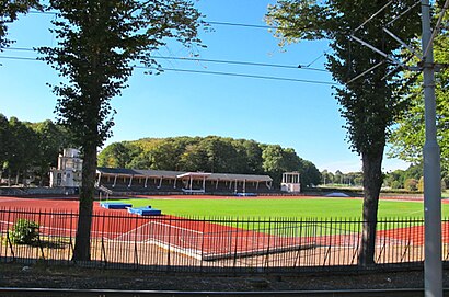
Slottsskogsvallen Address: Margretebergsgatan SE-413 19 Göteborg street in Stockholm
Attractions near Slottsskogsvallen
Slottsskogsvallen Boulebanan,Slottsskogens Petanque Club,Ullevis Friidrottsskola,Göteborgsvarvet,Göteborgs Friidrottsförbund,Coopy Företagsfoto,Virta,Tsg Karate Klubb Göteborg,Göteborgs Kvinnliga Idrottsklubb,Ik Vikingen,Parkeringsplats,M.I.T Fitness Gbg,Parkeringsplats,Slottskogsvallen Rinken,Göteborgs Konståkningsklubb Singel,Leon Lurje Trophy,Vastra Frolund,Frolunda Indians Lotte,Örgryte Is Friik,Idrottsföreningen KvilleHow to get to popular attractions in Stockholm with public transit
Hamnplan, Nyköping,Scandic Park, Stockholm,Jordbro, Haninge,MOOD Stockholm, Stockholm,Grand Hôtel Stockholm, Stockholm,Stadsgården, Tegelvikshamn, Stockholm,Jakobsbergs Bussterminal, Järfälla,Gräskö, Norrtälje,Fyrishov, Uppsala,Farstahallen, Stockholm,Intiman, Stockholm,Villa Källhagen, Stockholm,Flygbussarna Torsplan (B), Solna,Ikea, Uppsala,Gålö Havsbad, Haninge,MTR Express Stockholm-Göteborg, Stockholm,På min moped, Solna,Westfield Mall of Scandinavia, Solna,Norra Djurgårdsstaden, Stockholm,ICA Maxi Stormarknad Arlandastad, SigtunaGet around Stockholm by public transit!
Traveling around Stockholm has never been so easy. See step by step directions as you travel to any attraction, street or major public transit station. View bus and train schedules, arrival times, service alerts and detailed routes on a map, so you know exactly how to get to anywhere in Stockholm.
When traveling to any destination around Stockholm use Moovit's Live Directions with Get Off Notifications to know exactly where and how far to walk, how long to wait for your line, and how many stops are left. Moovit will alert you when it's time to get off — no need to constantly re-check whether yours is the next stop.
Wondering how to use public transit in Stockholm or how to pay for public transit in Stockholm? Moovit public transit app can help you navigate your way with public transit easily, and at minimum cost. It includes public transit fees, ticket prices, and costs. Looking for a map of Stockholm public transit lines? Moovit public transit app shows all public transit maps in Stockholm with all Bus, Train, Metro, Light Rail, Ferry and Cable Car routes and stops on an interactive map.
Stockholm has 6 transit type(s), including: Bus, Train, Metro, Light Rail, Ferry and Cable Car, operated by several transit agencies, including SL Tunnelbana, SL Spårvagn, SL Lokalbana, SL Rail, UL, Flygbussarna, Sörmlandstrafiken, X-trafik, Region Gotland, VL, Trosabussen, Vy Bus4You, Bergkvarabuss, Silverlinjen, Y-buss