S:T Eriksplan stop - Friday schedule
| Line | Direction | Time |
|---|---|---|
| 598 | Cityterminalen | 04:36 |
| 591 | Cityterminalen | 04:36 |
| 592 | Cityterminalen | 04:43 |
| 697 | Cityterminalen | 04:47 |
| 593 | Cityterminalen | 05:01 |
| 592 | Cityterminalen | 05:45 |
| 697 | Cityterminalen | 01:24 |
| 591 | Cityterminalen | 01:36 |
| 697 | Cityterminalen | 01:54 |
| 591 | Cityterminalen | 02:06 |
| 697 | Cityterminalen | 02:19 |
| 591 | Cityterminalen | 02:36 |
| 697 | Cityterminalen | 02:49 |
| 591 | Cityterminalen | 03:06 |
| 697 | Cityterminalen | 03:19 |
| 592 | Cityterminalen | 03:35 |
| 591 | Cityterminalen | 03:36 |
| 598 | Cityterminalen | 03:46 |
| 697 | Cityterminalen | 03:49 |
| 593 | Cityterminalen | 04:01 |
Directions to S:T Eriksplan (Stockholm) with public transportation
The following transit lines have routes that pass near S:T Eriksplan
How to get to S:T Eriksplan by bus?
Click on the bus route to see step by step directions with maps, line arrival times and updated time schedules.
How to get to S:T Eriksplan by train?
Click on the train route to see step by step directions with maps, line arrival times and updated time schedules.
How to get to S:T Eriksplan by metro?
Click on the metro route to see step by step directions with maps, line arrival times and updated time schedules.
Bus stops near S:T Eriksplan in Stockholm
- Dalagatan, 1 min walk,
- Stockholm S:T Eriksplan, 1 min walk,
- S:T Eriksplan T-Bana, 2 min walk,
- S:T Eriksplan, 2 min walk,
- S:T Eriksgatan, 5 min walk,
- S:T Eriksgatan (Karlbergsv), 6 min walk,
- Kronobergsgatan, 12 min walk,
- Kronobergsgatan (På Kungsholms Strand), 12 min walk,
Metro stations near S:T Eriksplan in Stockholm
- Fridhemsplan, 7 min walk,
Train stations near S:T Eriksplan in Stockholm
- Stockholm Odenplan Station, 13 min walk,
Bus lines to S:T Eriksplan in Stockholm
- 4, Gullmarsplan,
- 6, Ropsten,
- 94, Radiohuset,
- 507, Odenplan,
- 591, Råby,
- 592, Apoteksskogen,
- 593, Uppsala Centralstation,
- 595, Sundbybergs Station,
- 598, Runby Backar,
- 599, Brunnby Vik,
- 697, Danderyds Sjukhus,
- FLIXBUS, Stockholm Cityterminalen,
- FLYGBUSSARNA, Arlanda Terminal 2-3 Buss,
- 3, Karolinska Sjukhuset Norra,
- 77, Liljeholmen,
- 3, Södersjukhuset,
- 4, Radiohuset,
- 17, Hässelby Strand T-Bana,
- 18, Alvik T-Bana,
- 19, Alvik T-Bana,
What are the closest stations to S:T Eriksplan?
The closest stations to S:T Eriksplan are:
- Dalagatan is 27 meters away, 1 min walk.
- Stockholm S:T Eriksplan is 65 meters away, 1 min walk.
- S:T Eriksplan T-Bana is 75 meters away, 2 min walk.
- S:T Eriksplan is 79 meters away, 2 min walk.
- S:T Eriksgatan is 365 meters away, 5 min walk.
- S:T Eriksgatan (Karlbergsv) is 390 meters away, 6 min walk.
- Fridhemsplan is 526 meters away, 7 min walk.
- Kronobergsgatan is 860 meters away, 12 min walk.
- Kronobergsgatan (På Kungsholms Strand) is 867 meters away, 12 min walk.
- Stockholm Odenplan Station is 971 meters away, 13 min walk.
Which bus lines stop near S:T Eriksplan?
These bus lines stop near S:T Eriksplan: 3, 4, 77.
Which train lines stop near S:T Eriksplan?
These train lines stop near S:T Eriksplan: PENDELTÅG, ROSLAGSBANAN, UPPSALA CENTRALSTATION - SÖDERTÄLJE CENTRUM STATION.
Which metro lines stop near S:T Eriksplan?
These metro lines stop near S:T Eriksplan: 17, 18, 19.
What’s the nearest metro station to S:T Eriksplan in Stockholm?
The nearest metro station to S:T Eriksplan in Stockholm is Fridhemsplan. It’s a 7 min walk away.
What’s the nearest train station to S:T Eriksplan in Stockholm?
The nearest train station to S:T Eriksplan in Stockholm is Stockholm Odenplan Station. It’s a 13 min walk away.
What’s the nearest bus stop to S:T Eriksplan in Stockholm?
The nearest bus stops to S:T Eriksplan in Stockholm are Dalagatan and Stockholm S:T Eriksplan. The closest one is a 1 min walk away.
What time is the first metro to S:T Eriksplan in Stockholm?
The 11 is the first metro that goes to S:T Eriksplan in Stockholm. It stops nearby at 4:58 AM.
What time is the last metro to S:T Eriksplan in Stockholm?
The 11 is the last metro that goes to S:T Eriksplan in Stockholm. It stops nearby at 1:03 AM.
What time is the first train to S:T Eriksplan in Stockholm?
The PENDELTÅG is the first train that goes to S:T Eriksplan in Stockholm. It stops nearby at 4:09 AM.
What time is the last train to S:T Eriksplan in Stockholm?
The PENDELTÅG is the last train that goes to S:T Eriksplan in Stockholm. It stops nearby at 1:20 AM.
What time is the first bus to S:T Eriksplan in Stockholm?
The 697 is the first bus that goes to S:T Eriksplan in Stockholm. It stops nearby at 3:00 AM.
What time is the last bus to S:T Eriksplan in Stockholm?
The 593 is the last bus that goes to S:T Eriksplan in Stockholm. It stops nearby at 4:01 AM.
See S:T Eriksplan, Stockholm, on the map
Public transit to S:T Eriksplan stop in Stockholm
Looking for directions to S:T Eriksplan in Stockholm, Sweden?
Download the Moovit App to find the current schedule and step-by-step directions for Bus, Metro or Train routes that pass through S:T Eriksplan.
Looking for the nearest stops closest to S:T Eriksplan ? Check out this list of closest stops to your destination: Dalagatan; Stockholm S:T Eriksplan; S:T Eriksplan T-Bana; S:T Eriksplan; S:T Eriksgatan; S:T Eriksgatan (Karlbergsv); Fridhemsplan; Kronobergsgatan; Kronobergsgatan (På Kungsholms Strand); Stockholm Odenplan Station.
Bus: 3, 4, 77, 6, 94, 507, 591, 592, 593, 595, 598, FLIXBUS, FLYGBUSSARNA.Train: PENDELTÅG, ROSLAGSBANAN, UPPSALA CENTRALSTATION - SÖDERTÄLJE CENTRUM STATION, BÅLSTA STATION - NYNÄSHAMN STATION, KALLHÄLL STATION - TUMBA STATION, MÄRSTA STATION - NYNÄSHAMN STATION, SÖDERTÄLJE CENTRUM STATION - UPPSALA CENTRALSTATION.Metro: 17, 18, 19, 10, 11.
We make riding on public transit to S:T Eriksplan easy, which is why over 1.5 million users, including users in Stockholm trust Moovit as the best app for public transit.
Use the app to navigate to popular places including to the airport, hospital, stadium, grocery store, mall, coffee shop, school, college, and university.
The first line to this stop is 598, at 04:36, and the last line is 593 at 04:01.
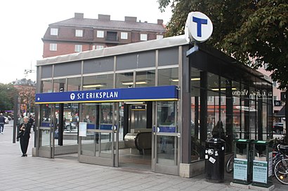
Sankt Eriksplan 1, Stockholm, Sweden
This stop serves SL’s lines
Bus stops near S:T Eriksplan
Dalagatan,Stockholm S:T Eriksplan,S:T Eriksplan T-Bana,S:T Eriksplan,S:T Eriksgatan,S:T Eriksgatan (Karlbergsv),Kronobergsgatan,Kronobergsgatan (På Kungsholms Strand)Metro station near S:T Eriksplan
FridhemsplanTrain station near S:T Eriksplan
Stockholm Odenplan StationPopular public transit stations in Stockholm
Långgarn,Uppsala Marknadsgatan,Rissnehallen,Solnahallen,Stortorps Äldrecentrum,Hötorget,Manilla,Garnisonen,Viksjöleden,Kapellskär,Biskops-Arnö Vägskäl,Skanssundet,Selaövägen,Kallhälls Station,Rånäs Slott,Eskilstuna Mälarsjukhuset,Fryksdalsbacken,Breddenvägen,Kontrollvägen,Täby KyrkbyGet around Stockholm by public transit!
Traveling around Stockholm has never been so easy. See step by step directions as you travel to any attraction, street or major public transit station. View bus and train schedules, arrival times, service alerts and detailed routes on a map, so you know exactly how to get to anywhere in Stockholm.
When traveling to any destination around Stockholm use Moovit's Live Directions with Get Off Notifications to know exactly where and how far to walk, how long to wait for your line, and how many stops are left. Moovit will alert you when it's time to get off — no need to constantly re-check whether yours is the next stop.
Wondering how to use public transit in Stockholm or how to pay for public transit in Stockholm? Moovit public transit app can help you navigate your way with public transit easily, and at minimum cost. It includes public transit fees, ticket prices, and costs. Looking for a map of Stockholm public transit lines? Moovit public transit app shows all public transit maps in Stockholm with all Bus, Train, Metro, Light Rail, Ferry and Cable Car routes and stops on an interactive map.
Stockholm has 6 transit type(s), including: Bus, Train, Metro, Light Rail, Ferry and Cable Car, operated by several transit agencies, including SL Tunnelbana, SL Spårvagn, SL Lokalbana, SL Rail, UL, Flygbussarna, Sörmlandstrafiken, X-trafik, Region Gotland, VL, Trosabussen, Vy Bus4You, Bergkvarabuss, Silverlinjen, Y-buss