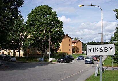
Directions to Riksby (Stockholm) with public transportation
The following transit lines have routes that pass near Riksby
How to get to Riksby by bus?
Click on the bus route to see step by step directions with maps, line arrival times and updated time schedules.
How to get to Riksby by train?
Click on the train route to see step by step directions with maps, line arrival times and updated time schedules.
How to get to Riksby by metro?
Click on the metro route to see step by step directions with maps, line arrival times and updated time schedules.
Bus stops near Riksby in Stockholm
- Brommaplan T-Bana, 11 min walk,
Bus lines to Riksby in Stockholm
- FLYGBUSSARNA, Brommaplan T-Bana,
What are the closest stations to Riksby?
The closest stations to Riksby are:
- Brommaplan T-Bana is 733 meters away, 11 min walk.
Which bus lines stop near Riksby?
These bus lines stop near Riksby: 176, 177, 302, 509.
Which train lines stop near Riksby?
These train lines stop near Riksby: 5535, 5583.
Which metro lines stop near Riksby?
These metro lines stop near Riksby: 17, 19.
What’s the nearest bus stop to Riksby in Stockholm?
The nearest bus stop to Riksby in Stockholm is Brommaplan T-Bana. It’s a 11 min walk away.
See Riksby, Stockholm, on the map
Public Transit to Riksby in Stockholm
Wondering how to get to Riksby in Stockholm, Sweden? Moovit helps you find the best way to get to Riksby with step-by-step directions from the nearest public transit station.
Moovit provides free maps and live directions to help you navigate through your city. View schedules, routes, timetables, and find out how long does it take to get to Riksby in real time.
Looking for the nearest stop or station to Riksby? Check out this list of stops closest to your destination: Brommaplan T-Bana.
Bus: 176, 177, 302, 509, FLYGBUSSARNA.Train: 5535, 5583.Metro: 17, 19.
Want to see if there’s another route that gets you there at an earlier time? Moovit helps you find alternative routes or times. Get directions from and directions to Riksby easily from the Moovit App or Website.
We make riding to Riksby easy, which is why over 1.5 million users, including users in Stockholm, trust Moovit as the best app for public transit. You don’t need to download an individual bus app or train app, Moovit is your all-in-one transit app that helps you find the best bus time or train time available.
For information on prices of bus, metro and train, costs and ride fares to Riksby, please check the Moovit app.
Use the app to navigate to popular places including to the airport, hospital, stadium, grocery store, mall, coffee shop, school, college, and university.
Riksby Address: Riksbyvägen street in Stockholm
Attractions near Riksby
Internationella Engelska Skolan Bromma,Riksbyvägen,Restaurang & Pizzeria Il Poste,Mattvägen,Riksbyvägen (B),Pedalogerna,Cafe O'Leo,SALK Tennis Park,Kvarnbacksvägen 108,Galonvägen 46,Damastvägen 4A,Damastvägen,Båtsmanstorpet,Vadmalsvägen Förskola,Galonparken,Byggmax,Brommaplans Hälsokost,168 74,Galonvägen,LintaHow to get to popular attractions in Stockholm with public transit
Karolinska Institutet, Solna,Viking Line Stockholm,Immanuelskyrkan, Stockholm,Götgatan, Stockholm,Täby Centrum, Täby,Clarion Collection Hotel Tapetfabriken, Nacka,Villa Spies, Nynäshamn,ABBA The Museum, Stockholm,Oscarskyrkan, Stockholm,Regeringsgatan, Stockholm,Botkyrka Kommun, Botkyrka,Saltsjöbaden, Nacka,Vega, Haninge,Saltsjöbaden, Nacka,Kärrtorps IP, Stockholm,Vårberg, Stockholm,TV4, Stockholm,Ingarö, Stockholm,Zetas trädgård och café, Stockholm,Stora Essingen, StockholmGet around Stockholm by public transit!
Traveling around Stockholm has never been so easy. See step by step directions as you travel to any attraction, street or major public transit station. View bus and train schedules, arrival times, service alerts and detailed routes on a map, so you know exactly how to get to anywhere in Stockholm.
When traveling to any destination around Stockholm use Moovit's Live Directions with Get Off Notifications to know exactly where and how far to walk, how long to wait for your line, and how many stops are left. Moovit will alert you when it's time to get off — no need to constantly re-check whether yours is the next stop.
Wondering how to use public transit in Stockholm or how to pay for public transit in Stockholm? Moovit public transit app can help you navigate your way with public transit easily, and at minimum cost. It includes public transit fees, ticket prices, and costs. Looking for a map of Stockholm public transit lines? Moovit public transit app shows all public transit maps in Stockholm with all Bus, Train, Metro, Light Rail, Ferry and Cable Car routes and stops on an interactive map.
Stockholm has 6 transit type(s), including: Bus, Train, Metro, Light Rail, Ferry and Cable Car, operated by several transit agencies, including SL Tunnelbana, SL Spårvagn, SL Lokalbana, SL Rail, UL, Flygbussarna, Sörmlandstrafiken, X-trafik, Region Gotland, VL, Trosabussen, Vy Bus4You, Bergkvarabuss, Silverlinjen, Y-buss