Directions to NORDITA (Stockholm) with public transportation
The following transit lines have routes that pass near NORDITA
How to get to NORDITA by bus?
Click on the bus route to see step by step directions with maps, line arrival times and updated time schedules.
How to get to NORDITA by train?
Click on the train route to see step by step directions with maps, line arrival times and updated time schedules.
How to get to NORDITA by metro?
Click on the metro route to see step by step directions with maps, line arrival times and updated time schedules.
Bus stops near NORDITA in Stockholm
- Ruddammen, 2 min walk,
- Roslagstull, 5 min walk,
- Roslagstull (På Ingemarsgatan), 7 min walk,
- Albano, 8 min walk,
- Roslagstull (På Valhallavägen), 12 min walk,
Metro stations near NORDITA in Stockholm
- Tekniska Högskolan, 6 min walk,
Train stations near NORDITA in Stockholm
- Stockholm Östra Station, 8 min walk,
- Stockholm Odenplan Station, 11 min walk,
Light Rail stations near NORDITA in Stockholm
- Stockholms Östra, 10 min walk,
Bus lines to NORDITA in Stockholm
- 61, Moa Martinsons Torg,
- 608, Rosengården - Humlegården,
- 624C, Tekniska högskolan - Åkersberga station,
- 628C, Tekniska högskolan - Margretelunds centrum,
- 670, Västerhamnsplan - Tekniska högskolan,
- 680, Överby - Tekniska högskolan,
- 690, Danderyds sjukhus - Rosengården,
- 691, Danderyds sjukhus - Pilotvägen,
- 696, Tekniska högskolan - Norrtälje busstation,
- 699, Västerhamnsplan - Tekniska högskolan,
- 50, Universitetet,
- 50, Odenplan T-Bana,
- 205, Universitetet T-bana - Sticklinge,
- 639, Hallstavik Hallsta pappersbruk - Tekniska Högskolan T-bana,
- 670, Vaxholm Västerhamnsplan - Tekniska Högskolan T-bana,
- 676, Norrtälje busstation - Tekniska Högskolan T-bana,
- 680, Överby - Tekniska Högskolan T-bana,
- 690, Danderyds sjukhus T-bana - Lindholmen station,
- 691, Odenplan T-bana - Pilotvägen,
- 696, Norrtälje busstation - Tekniska Högskolan T-bana,
What are the closest stations to NORDITA?
The closest stations to NORDITA are:
- Ruddammen is 147 meters away, 3 min walk.
- Roslagstull is 333 meters away, 5 min walk.
- Tekniska Högskolan is 422 meters away, 6 min walk.
- Roslagstull (På Ingemarsgatan) is 501 meters away, 7 min walk.
- Stockholm Östra Station is 554 meters away, 8 min walk.
- Albano is 563 meters away, 8 min walk.
- Stockholms Östra is 704 meters away, 10 min walk.
- Stockholm Odenplan Station is 790 meters away, 11 min walk.
- Roslagstull (På Valhallavägen) is 855 meters away, 12 min walk.
Which bus lines stop near NORDITA?
These bus lines stop near NORDITA: 4, 50, 57, 61, 670, 680.
Which train lines stop near NORDITA?
These train lines stop near NORDITA: PENDELTÅG, UPPSALA CENTRALSTATION - SÖDERTÄLJE CENTRUM STATION.
Which metro lines stop near NORDITA?
These metro lines stop near NORDITA: 14, 19.
What’s the nearest light rail station to NORDITA in Stockholm?
The nearest light rail station to NORDITA in Stockholm is Stockholms Östra. It’s a 10 min walk away.
What’s the nearest metro station to NORDITA in Stockholm?
The nearest metro station to NORDITA in Stockholm is Tekniska Högskolan. It’s a 6 min walk away.
What’s the nearest train station to NORDITA in Stockholm?
The nearest train station to NORDITA in Stockholm is Stockholm Östra Station. It’s a 8 min walk away.
What’s the nearest bus stop to NORDITA in Stockholm?
The nearest bus stop to NORDITA in Stockholm is Ruddammen. It’s a 3 min walk away.
What time is the first light rail to NORDITA in Stockholm?
The 28 is the first light rail that goes to NORDITA in Stockholm. It stops nearby at 4:54 AM.
What time is the last light rail to NORDITA in Stockholm?
The 27 is the last light rail that goes to NORDITA in Stockholm. It stops nearby at 1:00 AM.
What time is the first metro to NORDITA in Stockholm?
The 14 is the first metro that goes to NORDITA in Stockholm. It stops nearby at 5:10 AM.
What time is the last metro to NORDITA in Stockholm?
The 14 is the last metro that goes to NORDITA in Stockholm. It stops nearby at 12:59 AM.
What time is the first train to NORDITA in Stockholm?
The PENDELTÅG is the first train that goes to NORDITA in Stockholm. It stops nearby at 4:09 AM.
What time is the last train to NORDITA in Stockholm?
The PENDELTÅG is the last train that goes to NORDITA in Stockholm. It stops nearby at 1:20 AM.
What time is the first bus to NORDITA in Stockholm?
The 690 is the first bus that goes to NORDITA in Stockholm. It stops nearby at 3:02 AM.
What time is the last bus to NORDITA in Stockholm?
The 690 is the last bus that goes to NORDITA in Stockholm. It stops nearby at 3:42 AM.
See NORDITA, Stockholm, on the map
Public Transit to NORDITA in Stockholm
Wondering how to get to NORDITA in Stockholm, Sweden? Moovit helps you find the best way to get to NORDITA with step-by-step directions from the nearest public transit station.
Moovit provides free maps and live directions to help you navigate through your city. View schedules, routes, timetables, and find out how long does it take to get to NORDITA in real time.
Looking for the nearest stop or station to NORDITA? Check out this list of stops closest to your destination: Ruddammen; Roslagstull; Tekniska Högskolan; Roslagstull (På Ingemarsgatan); Stockholm Östra Station; Albano; Stockholms Östra; Stockholm Odenplan Station; Roslagstull (På Valhallavägen).
Bus: 4, 50, 57, 61, 670, 680.Train: PENDELTÅG, UPPSALA CENTRALSTATION - SÖDERTÄLJE CENTRUM STATION, ROSLAGSBANAN, ROSLAGSBANAN, ROSLAGSBANAN, ROSLAGSBANAN, KÅRSTA STATION - STOCKHOLM ÖSTRA STATION, STOCKHOLM ÖSTRA STATION - KÅRSTA STATION, STOCKHOLM ÖSTRA STATION - NÄSBYPARK STATION, STOCKHOLM ÖSTRA STATION - ÖSTERSKÄR STATION, ÖSTERSKÄR STATION - STOCKHOLM ÖSTRA STATION.Metro: 14, 19, 13.
Want to see if there’s another route that gets you there at an earlier time? Moovit helps you find alternative routes or times. Get directions from and directions to NORDITA easily from the Moovit App or Website.
We make riding to NORDITA easy, which is why over 1.5 million users, including users in Stockholm, trust Moovit as the best app for public transit. You don’t need to download an individual bus app or train app, Moovit is your all-in-one transit app that helps you find the best bus time or train time available.
For information on prices of bus, metro, train and light rail, costs and ride fares to NORDITA, please check the Moovit app.
Use the app to navigate to popular places including to the airport, hospital, stadium, grocery store, mall, coffee shop, school, college, and university.
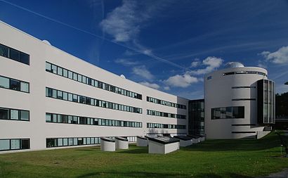
NORDITA Address: Roslagstullsbacken 23 street in Stockholm
Attractions near NORDITA
Nordita - Nordic Institute For Theoretical Physics,Vetenskapens Hus i Stockholm,Tenant & Partner in Sweden,Myhrman, Andreas Deuk Woo,AlbaNova,Kattrumpstullen,Roslagstullsbacken 13,Parkeringsplats,Roslagsparken,Valhallavägen 1,Vice Management Nordic,Skanska Albano,Brunbärsvägen 9,Tirmet Taxi,Mer,Alpingaraget,Birger Jarlsgatan 127,Roslagstulls återbruk,Proviant Albano,Kth MaskinHow to get to popular attractions in Stockholm with public transit
Scandic Malmen, Stockholm,Adelsö, Ekerö,Hotel Birger Jarl, Stockholm,Kungsholmen, Stockholm,M/S Viking Cinderella, Stockholm,Nåttarö, Haninge,Karolinska Universitetssjukhuset, Solna,Flemingsberg, Huddinge,2019 Az Nord Up, Uppsala,Pendeltåg 40 Emot Södertälje C, Stockholm,Hägersten, Stockholm,Fyrisborg Uppsala Kommun, Uppsala,Nordiska Museet, Stockholm,Norra Djurgården, Stockholm,Grödinge, Botkyrka,Sturehof Slott & Café, Ekerö,Sephora, Stockholm,Vasagatan Centralstationen, Stockholm,Courtyard by Marriott Stockholm Kungsholmen, Stockholm,Hökarängen, StockholmGet around Stockholm by public transit!
Traveling around Stockholm has never been so easy. See step by step directions as you travel to any attraction, street or major public transit station. View bus and train schedules, arrival times, service alerts and detailed routes on a map, so you know exactly how to get to anywhere in Stockholm.
When traveling to any destination around Stockholm use Moovit's Live Directions with Get Off Notifications to know exactly where and how far to walk, how long to wait for your line, and how many stops are left. Moovit will alert you when it's time to get off — no need to constantly re-check whether yours is the next stop.
Wondering how to use public transit in Stockholm or how to pay for public transit in Stockholm? Moovit public transit app can help you navigate your way with public transit easily, and at minimum cost. It includes public transit fees, ticket prices, and costs. Looking for a map of Stockholm public transit lines? Moovit public transit app shows all public transit maps in Stockholm with all Bus, Train, Metro, Light Rail, Ferry and Cable Car routes and stops on an interactive map.
Stockholm has 6 transit type(s), including: Bus, Train, Metro, Light Rail, Ferry and Cable Car, operated by several transit agencies, including SL Tunnelbana, SL Spårvagn, SL Lokalbana, SL Rail, UL, Flygbussarna, Sörmlandstrafiken, X-trafik, Region Gotland, VL, Trosabussen, Vy Bus4You, Bergkvarabuss, Silverlinjen, Y-buss