Directions to Mynttorget (Stockholm) with public transportation
The following transit lines have routes that pass near Mynttorget
How to get to Mynttorget by bus?
Click on the bus route to see step by step directions with maps, line arrival times and updated time schedules.
How to get to Mynttorget by train?
Click on the train route to see step by step directions with maps, line arrival times and updated time schedules.
How to get to Mynttorget by metro?
Click on the metro route to see step by step directions with maps, line arrival times and updated time schedules.
Bus stops near Mynttorget in Stockholm
- Riddarhustorget, 3 min walk,
- Slottsbacken, 6 min walk,
- Gustav Adolfs Torg, 8 min walk,
Metro stations near Mynttorget in Stockholm
- Gamla Stan, 4 min walk,
- Gamla Stan T-Bana, 4 min walk,
Ferry stations near Mynttorget in Stockholm
- Strömkajen, 7 min walk,
- Stockholm Strömkajen, 9 min walk,
Bus lines to Mynttorget in Stockholm
- 3, Karolinska Sjukhuset Norra,
- 53, Karolinska Institutet Västra,
- 3, Södersjukhuset,
- 2, Barnängen - Stockholm Sveaplan,
- 57, Motalavägen - Tullgårdsparken,
- 76, Ropsten T-bana - Ljusterögatan,
- 96, Stockholm Sickla Udde - Odenplan T-bana,
- 191, Norsborg T-bana - Stockholm C Klarabergsviadukte,
- 192, Stockholm C Klarabergsviadukte - Fruängen T-bana,
- 193, Stockholm C Klarabergsviadukte - Farsta strandplan,
- 194, Stockholm C Klarabergsviadukte - Bagarmossen T-bana,
- 195, Stockholm C Klarabergsviadukte - Hagsätra,
- 2, Sveaplan,
- 57, Motalavägen,
- 76, Ljusterögatan,
- 96, Odenplan,
- 191, Centralen,
- 192, Fruängen,
- 193, Farsta Strandplan,
- 194, Bagarmossen,
What are the closest stations to Mynttorget?
The closest stations to Mynttorget are:
- Riddarhustorget is 214 meters away, 3 min walk.
- Gamla Stan is 251 meters away, 4 min walk.
- Gamla Stan T-Bana is 286 meters away, 4 min walk.
- Slottsbacken is 452 meters away, 6 min walk.
- Strömkajen is 526 meters away, 7 min walk.
- Gustav Adolfs Torg is 579 meters away, 8 min walk.
- Stockholm Strömkajen is 627 meters away, 9 min walk.
Which bus lines stop near Mynttorget?
These bus lines stop near Mynttorget: 3, 57, 65.
Which train lines stop near Mynttorget?
These train lines stop near Mynttorget: PENDELTÅG, ROSLAGSBANAN, UPPSALA CENTRALSTATION - SÖDERTÄLJE CENTRUM STATION.
Which metro lines stop near Mynttorget?
These metro lines stop near Mynttorget: 11, 13, 14, 17, 18.
What’s the nearest metro station to Mynttorget in Stockholm?
The nearest metro stations to Mynttorget in Stockholm are Gamla Stan and Gamla Stan T-Bana. The closest one is a 4 min walk away.
What’s the nearest bus stop to Mynttorget in Stockholm?
The nearest bus stop to Mynttorget in Stockholm is Riddarhustorget. It’s a 3 min walk away.
What’s the nearest ferry station to Mynttorget in Stockholm?
The nearest ferry station to Mynttorget in Stockholm is Strömkajen. It’s a 7 min walk away.
What time is the first metro to Mynttorget in Stockholm?
The 13 is the first metro that goes to Mynttorget in Stockholm. It stops nearby at 4:59 AM.
What time is the last metro to Mynttorget in Stockholm?
The 13 is the last metro that goes to Mynttorget in Stockholm. It stops nearby at 12:54 AM.
What time is the first bus to Mynttorget in Stockholm?
The 191 is the first bus that goes to Mynttorget in Stockholm. It stops nearby at 3:02 AM.
What time is the last bus to Mynttorget in Stockholm?
The 195 is the last bus that goes to Mynttorget in Stockholm. It stops nearby at 3:09 AM.
What time is the first ferry to Mynttorget in Stockholm?
The 84 is the first ferry that goes to Mynttorget in Stockholm. It stops nearby at 6:15 AM.
What time is the last ferry to Mynttorget in Stockholm?
The 13 is the last ferry that goes to Mynttorget in Stockholm. It stops nearby at 10:30 PM.
See Mynttorget, Stockholm, on the map
Public Transit to Mynttorget in Stockholm
Wondering how to get to Mynttorget in Stockholm, Sweden? Moovit helps you find the best way to get to Mynttorget with step-by-step directions from the nearest public transit station.
Moovit provides free maps and live directions to help you navigate through your city. View schedules, routes, timetables, and find out how long does it take to get to Mynttorget in real time.
Looking for the nearest stop or station to Mynttorget? Check out this list of stops closest to your destination: Riddarhustorget; Gamla Stan; Gamla Stan T-Bana; Slottsbacken; Strömkajen; Gustav Adolfs Torg; Stockholm Strömkajen.
Bus: 3, 57, 65, 53, 53, 2, 76, 96, 191.Train: PENDELTÅG, ROSLAGSBANAN, UPPSALA CENTRALSTATION - SÖDERTÄLJE CENTRUM STATION.Metro: 11, 13, 14, 17, 18, 19, 19.Ferry: 2, 4, 5, 8, 9.
Want to see if there’s another route that gets you there at an earlier time? Moovit helps you find alternative routes or times. Get directions from and directions to Mynttorget easily from the Moovit App or Website.
We make riding to Mynttorget easy, which is why over 1.5 million users, including users in Stockholm, trust Moovit as the best app for public transit. You don’t need to download an individual bus app or train app, Moovit is your all-in-one transit app that helps you find the best bus time or train time available.
For information on prices of bus, metro, train and light rail, costs and ride fares to Mynttorget, please check the Moovit app.
Use the app to navigate to popular places including to the airport, hospital, stadium, grocery store, mall, coffee shop, school, college, and university.
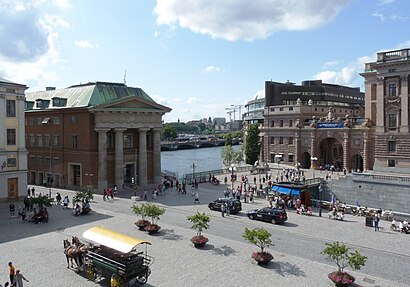
Mynttorget Address: Slottskajen street in Stockholm
Mynttorget (Swedish: [ˈmʏ̂ntˌtɔrjɛt], "the Coin Square") is a public square in Gamla stan, the old town in central Stockholm, Sweden.Wiki
Attractions near Mynttorget
Skandiasalen,Tage Erlanders Plats,Miljöpartiet de Gröna,Letiz Gelato,Kanslihuset,An - Mira 3,Brantingtorget,Old Town,Yttre Borggården,Royal Treasury,Yttre borggården (Parade Square),Classic Swedish Souvenir AB,Sveriges Riksdag,E.ON,Riksdagsrestaurangen,RÖ2 Mittpoolen,Lady Hamilton Hotel,Lofgren Antik,Riksdagshuset,Parliament House SwedenHow to get to popular attractions in Stockholm with public transit
SU Albano Campus, Stockholm,Eriksdalshallen, Stockholm,Downtown Camper By Scandic, Stockholm,Steam Hotel, Västerås,Lappis beach, Stockholm,Saltsjö-boo, Nacka,Scalateatern, Stockholm,Jakobsberg, Järfälla,Silja Line Terminal, Stockholm,Fjällgatan 44, Stockholm,Solna Centrum (S) Tvärbanan, Solna,Sveavägen, Stockholm,Scandic Malmen, Stockholm,Högklint, Gotland,Yasuragi Hasseludden, Nacka,Ersättningsbuss 35A, Järfälla,Vitabergsparken, Stockholm,IFU Arena, Uppsala,Stockholms Central, Stockholm,Fjärilshuset Haga Ocean, SolnaGet around Stockholm by public transit!
Traveling around Stockholm has never been so easy. See step by step directions as you travel to any attraction, street or major public transit station. View bus and train schedules, arrival times, service alerts and detailed routes on a map, so you know exactly how to get to anywhere in Stockholm.
When traveling to any destination around Stockholm use Moovit's Live Directions with Get Off Notifications to know exactly where and how far to walk, how long to wait for your line, and how many stops are left. Moovit will alert you when it's time to get off — no need to constantly re-check whether yours is the next stop.
Wondering how to use public transit in Stockholm or how to pay for public transit in Stockholm? Moovit public transit app can help you navigate your way with public transit easily, and at minimum cost. It includes public transit fees, ticket prices, and costs. Looking for a map of Stockholm public transit lines? Moovit public transit app shows all public transit maps in Stockholm with all Bus, Train, Metro, Light Rail, Ferry and Cable Car routes and stops on an interactive map.
Stockholm has 6 transit type(s), including: Bus, Train, Metro, Light Rail, Ferry and Cable Car, operated by several transit agencies, including SL Tunnelbana, SL Spårvagn, SL Lokalbana, SL Rail, UL, Flygbussarna, Sörmlandstrafiken, X-trafik, Region Gotland, VL, Trosabussen, Vy Bus4You, Bergkvarabuss, Silverlinjen, Y-buss