Directions to Lidingö kommun with public transportation
The following transit lines have routes that pass near Lidingö kommun
How to get to Lidingö kommun by bus?
Click on the bus route to see step by step directions with maps, line arrival times and updated time schedules.
Bus stops near Lidingö kommun
- Holavedsvägen, 2 min walk,
- Käppala Station, 4 min walk,
Light Rail stations near Lidingö kommun
- Käppala, 5 min walk,
Ferry stations near Lidingö kommun
- Gåshaga Brygga, 15 min walk,
Bus lines to Lidingö kommun
- 921, Jupitervägen,
- 921, Servicehuset Tor,
- 291, Cityterminalen,
- ROPSTEN T-BANA - GÅSHAGA BRYGGA STATION, Gåshaga Brygga Station,
- 291, Stockholm Citytermin Kungsbron,
What are the closest stations to Lidingö kommun?
The closest stations to Lidingö kommun are:
- Holavedsvägen is 81 meters away, 2 min walk.
- Käppala Station is 220 meters away, 4 min walk.
- Käppala is 280 meters away, 5 min walk.
- Gåshaga Brygga is 1106 meters away, 15 min walk.
Which bus line stops near Lidingö kommun?
201
Which light rail line stops near Lidingö kommun?
ROPSTEN T-BANA - GÅSHAGA BRYGGA STATION
Which ferry line stops near Lidingö kommun?
13
What’s the nearest light rail station to Lidingö kommun?
The nearest light rail station to Lidingö kommun is Käppala. It’s a 5 min walk away.
What’s the nearest bus stop to Lidingö kommun?
The nearest bus stop to Lidingö kommun is Holavedsvägen. It’s a 2 min walk away.
What’s the nearest ferry station to Lidingö kommun?
The nearest ferry station to Lidingö kommun is Gåshaga Brygga. It’s a 15 min walk away.
What time is the first light rail to Lidingö kommun?
The ROPSTEN T-BANA - GÅSHAGA BRYGGA STATION is the first light rail that goes to Lidingö kommun. It stops nearby at 5:55 AM.
What time is the last light rail to Lidingö kommun?
The ROPSTEN T-BANA - GÅSHAGA BRYGGA STATION is the last light rail that goes to Lidingö kommun. It stops nearby at 1:10 AM.
What time is the first bus to Lidingö kommun?
The 291 is the first bus that goes to Lidingö kommun. It stops nearby at 3:01 AM.
What time is the last bus to Lidingö kommun?
The 291 is the last bus that goes to Lidingö kommun. It stops nearby at 3:20 AM.
What time is the first ferry to Lidingö kommun?
The 83 is the first ferry that goes to Lidingö kommun. It stops nearby at 8:53 AM.
What time is the last ferry to Lidingö kommun?
The 83 is the last ferry that goes to Lidingö kommun. It stops nearby at 7:13 PM.
How much is the ferry fare to Lidingö kommun?
The ferry fare to Lidingö kommun costs about kr61.00.
How much is the bus fare to Lidingö kommun?
The bus fare to Lidingö kommun costs about kr39.00.
How much is the metro fare to Lidingö kommun?
The metro fare to Lidingö kommun costs about kr39.00.
See Lidingö kommun on the map
Public Transportation to Lidingö kommun
Wondering how to get to Lidingö kommun, Sweden? Moovit helps you find the best way to get to Lidingö kommun with step-by-step directions from the nearest public transit station.
Moovit provides free maps and live directions to help you navigate through your city. View schedules, routes, timetables, and find out how long does it take to get to Lidingö kommun in real time.
Looking for the nearest stop or station to Lidingö kommun? Check out this list of stops closest to your destination: Holavedsvägen; Käppala Station; Käppala; Gåshaga Brygga.
Bus: 201, 921, 921, 291, ROPSTEN T-BANA - GÅSHAGA BRYGGA STATION, 291.Light Rail: ROPSTEN T-BANA - GÅSHAGA BRYGGA STATION.Ferry: 13, 83, 83X.
Want to see if there’s another route that gets you there at an earlier time? Moovit helps you find alternative routes or times. Get directions from and directions to Lidingö kommun easily from the Moovit App or Website.
We make riding to Lidingö kommun easy, which is why over 1.5 million users, including users in Lidingö, trust Moovit as the best app for public transit. You don’t need to download an individual bus app or train app, Moovit is your all-in-one transit app that helps you find the best bus time or train time available.
For information on prices of bus, metro, light rail and ferry, costs and ride fares to Lidingö kommun, please check the Moovit app.
Use the app to navigate to popular places including to the airport, hospital, stadium, grocery store, mall, coffee shop, school, college, and university.
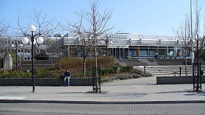
Lidingö kommun Address: Herkulesvägen 36 SE-181 64 Lidingö street in Lidingö
Attractions near Lidingö kommun
Svensk Drakklubb,Holaveden,E.M. Lindén Yacht and Conference Services,Joanna Bois-Bush Familjedaghem,Lidingöbanan-Käppala,Käppala (L),Hårstudion,Salong Stora Krullet,Gåshaga,Käppala,Aimo park,Calle Svennersjö VVS Service,Elke Fagerudd,Gerhard Byman Arkitektkontor,Ji Hudvård,Killinge,Fri Tanke Förlag,Käppala Skola,Futuraskolan,GåshagaHow to get to popular attractions in Lidingö with public transit
Pukholmen, Vaxholm,Polisen Globen, Stockholm,Stockholms Stadion, Stockholm,Vasagatan Centralstationen, Stockholm,Jakobsgatan 6, Stockholm,Sankt Göransplan 1, Solna,Sköndal, Stockholm,Grev Turegatan, Stockholm,Vitabergsparken, Stockholm,Flygbussarna Frösundavik (B), Solna,Västmanlands sjukhus Västerås, Västerås,Scandic Talk, Stockholm,Stockholms Auktionsverk Magasin 5, Stockholm,Högdalen, Stockholm,Skogskapellet, Stockholm,Djurgårdsfärjan, Stockholm,Ersta sjukhus (B), Stockholm,Djurhamn, Värmdö,Bredden, Upplands-Väsby,Gräskö, NorrtäljeGet around Stockholm by public transit!
Traveling around Stockholm has never been so easy. See step by step directions as you travel to any attraction, street or major public transit station. View bus and train schedules, arrival times, service alerts and detailed routes on a map, so you know exactly how to get to anywhere in Stockholm.
When traveling to any destination around Stockholm use Moovit's Live Directions with Get Off Notifications to know exactly where and how far to walk, how long to wait for your line, and how many stops are left. Moovit will alert you when it's time to get off — no need to constantly re-check whether yours is the next stop.
Wondering how to use public transit in Stockholm or how to pay for public transit in Stockholm? Moovit public transit app can help you navigate your way with public transit easily, and at minimum cost. It includes public transit fees, ticket prices, and costs. Looking for a map of Stockholm public transit lines? Moovit public transit app shows all public transit maps in Stockholm with all Bus, Train, Metro, Light Rail, Ferry and Cable Car routes and stops on an interactive map.
Stockholm has 6 transit type(s), including: Bus, Train, Metro, Light Rail, Ferry and Cable Car, operated by several transit agencies, including SL Tunnelbana, SL Spårvagn, SL Lokalbana, SL Rail, UL, Flygbussarna, Sörmlandstrafiken, X-trafik, Region Gotland, VL, Trosabussen, Vy Bus4You, Bergkvarabuss, Silverlinjen, Y-buss