Directions to Katrineholm C with public transportation
The following transit lines have routes that pass near Katrineholm C
How to get to Katrineholm C by bus?
Click on the bus route to see step by step directions with maps, line arrival times and updated time schedules.
How to get to Katrineholm C by train?
Click on the train route to see step by step directions with maps, line arrival times and updated time schedules.
Train stations near Katrineholm C
- Katrineholm Centralstation, 2 min walk,
What are the closest stations to Katrineholm C?
The closest stations to Katrineholm C are:
- Katrineholm Centralstation is 81 meters away, 2 min walk.
Which bus lines stop near Katrineholm C?
These bus lines stop near Katrineholm C: 414, 765.
Which train lines stop near Katrineholm C?
These train lines stop near Katrineholm C: 125, 2115, GÖTEBORG CENTRALSTATION - STOCKHOLM CENTRALSTATION, MTRX, STOCKHOLM CENTRALSTATION - ÄNGELHOLM STATION, STOCKHOLM CENTRALSTATION - GÖTEBORG CENTRALSTATION.
What’s the nearest train station to Katrineholm C?
The nearest train station to Katrineholm C is Katrineholm Centralstation. It’s a 2 min walk away.
What time is the first train to Katrineholm C?
The 118 is the first train that goes to Katrineholm C. It stops nearby at 5:54 AM.
What time is the last train to Katrineholm C?
The 151 is the last train that goes to Katrineholm C. It stops nearby at 11:06 PM.
What time is the first bus to Katrineholm C?
The 730 is the first bus that goes to Katrineholm C. It stops nearby at 5:00 AM.
What time is the last bus to Katrineholm C?
The 481 is the last bus that goes to Katrineholm C. It stops nearby at 12:16 AM.
See Katrineholm C on the map
Public Transportation to Katrineholm C
Wondering how to get to Katrineholm C, Sweden? Moovit helps you find the best way to get to Katrineholm C with step-by-step directions from the nearest public transit station.
Moovit provides free maps and live directions to help you navigate through your city. View schedules, routes, timetables, and find out how long does it take to get to Katrineholm C in real time.
Looking for the nearest stop or station to Katrineholm C? Check out this list of stops closest to your destination: Katrineholm Centralstation.
Bus: 414, 765.Train: 125, 2115, GÖTEBORG CENTRALSTATION - STOCKHOLM CENTRALSTATION, MTRX, STOCKHOLM CENTRALSTATION - ÄNGELHOLM STATION, STOCKHOLM CENTRALSTATION - GÖTEBORG CENTRALSTATION, DEGERFORS STATION - GÖTEBORG CENTRALSTATION, KARLSTAD CENTRALSTATION - STOCKHOLM CENTRALSTATION, KARLSTAD CENTRALSTATION - STOCKHOLM CENTRALSTATION, KIL STATION - STOCKHOLM CENTRALSTATION, GÖTEBORG CENTRALSTATION - SOLNA STATION, KARLSTAD CENTRALSTATION - STOCKHOLM CENTRALSTATION.
Want to see if there’s another route that gets you there at an earlier time? Moovit helps you find alternative routes or times. Get directions from and directions to Katrineholm C easily from the Moovit App or Website.
We make riding to Katrineholm C easy, which is why over 1.5 million users, including users in Katrineholm, trust Moovit as the best app for public transit. You don’t need to download an individual bus app or train app, Moovit is your all-in-one transit app that helps you find the best bus time or train time available.
For information on prices of train and bus, costs and ride fares to Katrineholm C, please check the Moovit app.
Use the app to navigate to popular places including to the airport, hospital, stadium, grocery store, mall, coffee shop, school, college, and university.
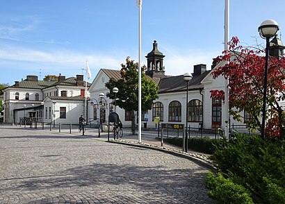
Katrineholm C Address: Stationsplan street in Katrineholm
Attractions near Katrineholm C
Katrineholms Centralstation,Rivieran Katrineholm,Annas Gröna Rum,Sultans Konditori,Davicia AB,ANA Sushi,Presto Brandsäkerhet,Katrineholms Resecentrum,Forsa Bruks Byalag Ekonomisk Fören,Torget Katrineholm,Loket,Mcdonald's,Bankomat,I Min Lilla Varld av B,Tandläkare Håkan Sköldin,Forza Dental AB,Nybergs,Epton Trading,Bela,Kronans ApotekHow to get to popular attractions in Katrineholm with public transit
Clarion Collection Hotel Tapto, Stockholm,Gotlandsbåten, Nynäshamn,Friends Arena, Solna,Virkesvägen 21, Stockholm,ABBA The Museum, Stockholm,Solna Centrum , Solna,Platform 1/2 (Spår 1-2), Stockholm,Stockholms City passexpedition, Stockholm,Brunna, Upplands-Bro,Sten Sture-Monumentet, Uppsala,Bus Grisslehamn-Stockholm, Norrtälje,Clarion Hotel Stockholm, Stockholm,Monitor Erp Arena, Gävle,Stockholms Sjukhem, Stockholm,Stadsgården, Stockholm,Tyresta Nationalpark, Tyresö,Väddö, Norrtälje,Mälardalens Högskola, Västerås,Hantverkargatan, Stockholm,Scandic Victoria Tower, SollentunaGet around Stockholm by public transit!
Traveling around Stockholm has never been so easy. See step by step directions as you travel to any attraction, street or major public transit station. View bus and train schedules, arrival times, service alerts and detailed routes on a map, so you know exactly how to get to anywhere in Stockholm.
When traveling to any destination around Stockholm use Moovit's Live Directions with Get Off Notifications to know exactly where and how far to walk, how long to wait for your line, and how many stops are left. Moovit will alert you when it's time to get off — no need to constantly re-check whether yours is the next stop.
Wondering how to use public transit in Stockholm or how to pay for public transit in Stockholm? Moovit public transit app can help you navigate your way with public transit easily, and at minimum cost. It includes public transit fees, ticket prices, and costs. Looking for a map of Stockholm public transit lines? Moovit public transit app shows all public transit maps in Stockholm with all Bus, Train, Metro, Light Rail, Ferry and Cable Car routes and stops on an interactive map.
Stockholm has 6 transit type(s), including: Bus, Train, Metro, Light Rail, Ferry and Cable Car, operated by several transit agencies, including SL Tunnelbana, SL Spårvagn, SL Lokalbana, SL Rail, UL, Flygbussarna, Sörmlandstrafiken, X-trafik, Region Gotland, VL, Trosabussen, Vy Bus4You, Bergkvarabuss, Silverlinjen, Y-buss