Directions to Kaknästornet (Stockholm) with public transportation
The following transit lines have routes that pass near Kaknästornet
How to get to Kaknästornet by bus?
Click on the bus route to see step by step directions with maps, line arrival times and updated time schedules.
How to get to Kaknästornet by metro?
Click on the metro route to see step by step directions with maps, line arrival times and updated time schedules.
Bus stops near Kaknästornet in Stockholm
- Stockholm Kaknästornet Södra, 1 min walk,
- Kaknästornet Södra, 1 min walk,
- Frihamnen, 18 min walk,
- Bellmansro, 21 min walk,
Ferry stations near Kaknästornet in Stockholm
- Frihamnen, 31 min walk,
Bus lines to Kaknästornet in Stockholm
- 69, Djurgårdsbrunn,
- 1, Frihamnen - Essingetorget,
- 76, Ljusterögatan - Ropsten,
- 91, Frihamnen - Essingetorget,
- 7, Waldemarsudde,
What are the closest stations to Kaknästornet?
The closest stations to Kaknästornet are:
- Stockholm Kaknästornet Södra is 23 meters away, 1 min walk.
- Kaknästornet Södra is 47 meters away, 1 min walk.
- Frihamnen is 1358 meters away, 18 min walk.
- Bellmansro is 1575 meters away, 21 min walk.
Which bus lines stop near Kaknästornet?
These bus lines stop near Kaknästornet: 69, 72.
Which metro line stops near Kaknästornet?
13
What’s the nearest bus stop to Kaknästornet in Stockholm?
The nearest bus stops to Kaknästornet in Stockholm are Stockholm Kaknästornet Södra and Kaknästornet Södra. The closest one is a 1 min walk away.
What time is the first light rail to Kaknästornet in Stockholm?
The 7 is the first light rail that goes to Kaknästornet in Stockholm. It stops nearby at 5:15 AM.
What time is the last light rail to Kaknästornet in Stockholm?
The 7 is the last light rail that goes to Kaknästornet in Stockholm. It stops nearby at 12:00 AM.
What time is the first bus to Kaknästornet in Stockholm?
The 91 is the first bus that goes to Kaknästornet in Stockholm. It stops nearby at 3:23 AM.
What time is the last bus to Kaknästornet in Stockholm?
The 91 is the last bus that goes to Kaknästornet in Stockholm. It stops nearby at 3:23 AM.
What time is the first ferry to Kaknästornet in Stockholm?
The 80 is the first ferry that goes to Kaknästornet in Stockholm. It stops nearby at 5:49 AM.
What time is the last ferry to Kaknästornet in Stockholm?
The 80 is the last ferry that goes to Kaknästornet in Stockholm. It stops nearby at 11:55 PM.
See Kaknästornet, Stockholm, on the map
Public Transit to Kaknästornet in Stockholm
Wondering how to get to Kaknästornet in Stockholm, Sweden? Moovit helps you find the best way to get to Kaknästornet with step-by-step directions from the nearest public transit station.
Moovit provides free maps and live directions to help you navigate through your city. View schedules, routes, timetables, and find out how long does it take to get to Kaknästornet in real time.
Looking for the nearest stop or station to Kaknästornet? Check out this list of stops closest to your destination: Stockholm Kaknästornet Södra; Kaknästornet Södra; Frihamnen; Bellmansro.
Bus: 69, 72, 1, 76, 91, 7, 7.Metro: 13.Ferry: 80, 80.
Want to see if there’s another route that gets you there at an earlier time? Moovit helps you find alternative routes or times. Get directions from and directions to Kaknästornet easily from the Moovit App or Website.
We make riding to Kaknästornet easy, which is why over 1.5 million users, including users in Stockholm, trust Moovit as the best app for public transit. You don’t need to download an individual bus app or train app, Moovit is your all-in-one transit app that helps you find the best bus time or train time available.
For information on prices of bus, metro and train, costs and ride fares to Kaknästornet, please check the Moovit app.
Use the app to navigate to popular places including to the airport, hospital, stadium, grocery store, mall, coffee shop, school, college, and university.
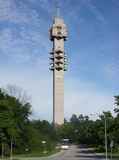
Kaknästornet Address: Mörka Kroken street in Stockholm
Attractions near Kaknästornet
Teracom AB,Stockholm Kaknästornet,Kaknäs Äventyrslekplats,Kaknästornet (B),Kinas Ambassad,Lidovägen 8,Folkrepubliken Kinas Ambassad,Djurgårdsbrunnsvägen 34,Etnografiska Museet,Villa Lido,Lidovägen 22,Djurgårdens Träningsanläggning,Kaknäsvägen,Polismuseet,Swedish National Museum of Science and Technology,Museivägen 7,Tekniska Museet,Tekniska Museet Shop,Kaknäs Djurkyrkogård,Djurgårdsbrunnsvägen 68How to get to popular attractions in Stockholm with public transit
The Winery Hotel, Solna,Nacka Aula, Nacka,Kokpunkten, Västerås,Rapsgatan 8, Uppsala,Tvärbanan-Gullmarsplan, Stockholm,Enskede Kyrka, Stockholm,Fåfängan, Stockholm,SL Center, Stockholm,Scandic Hotel Infra City, Upplands-Väsby,Hoppets Kapell, Stockholm,Sturegatan, Stockholm,Viking Line Terminal, Stockholm,Buss Grisslehamn - Uppsala, Norrtälje,Sheraton Hotel, Stockholm,Aleris Röntgen Järva, Stockholm,Thuns, Uppsala,Storholmen,Nyckelviken, Nacka,S:t Eriksplan, Stockholm,polisens utbildningsplats Rosersberg, SigtunaGet around Stockholm by public transit!
Traveling around Stockholm has never been so easy. See step by step directions as you travel to any attraction, street or major public transit station. View bus and train schedules, arrival times, service alerts and detailed routes on a map, so you know exactly how to get to anywhere in Stockholm.
When traveling to any destination around Stockholm use Moovit's Live Directions with Get Off Notifications to know exactly where and how far to walk, how long to wait for your line, and how many stops are left. Moovit will alert you when it's time to get off — no need to constantly re-check whether yours is the next stop.
Wondering how to use public transit in Stockholm or how to pay for public transit in Stockholm? Moovit public transit app can help you navigate your way with public transit easily, and at minimum cost. It includes public transit fees, ticket prices, and costs. Looking for a map of Stockholm public transit lines? Moovit public transit app shows all public transit maps in Stockholm with all Bus, Train, Metro, Light Rail, Ferry and Cable Car routes and stops on an interactive map.
Stockholm has 6 transit type(s), including: Bus, Train, Metro, Light Rail, Ferry and Cable Car, operated by several transit agencies, including SL Tunnelbana, SL Spårvagn, SL Lokalbana, SL Rail, UL, Flygbussarna, Sörmlandstrafiken, X-trafik, Region Gotland, VL, Trosabussen, Vy Bus4You, Bergkvarabuss, Silverlinjen, Y-buss