Directions to Haninge kommun with public transportation
The following transit lines have routes that pass near Haninge kommun
How to get to Haninge kommun by bus?
Click on the bus route to see step by step directions with maps, line arrival times and updated time schedules.
How to get to Haninge kommun by train?
Click on the train route to see step by step directions with maps, line arrival times and updated time schedules.
Train stations near Haninge kommun
- Jordbro Station, 5 min walk,
- Västerhaninge Station, 37 min walk,
- Handen Station, 47 min walk,
Bus stops near Haninge kommun
- Jordbro Station, 5 min walk,
- Jordbro Station Nynäsvägen, 7 min walk,
- Lerstensvägen, 9 min walk,
Bus lines to Haninge kommun
- 837, Jordbro station - Vega station,
- 838, Haninge centrum - Port 73,
- 892, Gullmarsplan - Jordbro station,
- 43B, Farsta Strand T-Bana,
- 45B, Gröndalsviken Station,
- 827, Lillsjövägen,
- 835, Truckvägen,
- 842, Dåntorpsvägen Västra,
- 893, Lillgården,
- BÅLSTA STATION - NYNÄSHAMN STATION, Kallhäll Station,
- 837, Jordbro Station,
- 838, Sjukhusentrén,
- 892, Stockholm C Klarabergsviadukte,
- 43B, Gröndalsvikens station - Västerhaninge station,
- 45B, Farsta strand - Gröndalsvikens station,
- 827, Dåntorpsvägen västra - Lillsjövägen,
- 835, Lillgården - Vardövägen,
- 842, Dåntorpsvägen västra - Sågen,
- 893, Centralen - Lillgården,
- 810, Västerbommen,
What are the closest stations to Haninge kommun?
The closest stations to Haninge kommun are:
- Jordbro Station is 341 meters away, 5 min walk.
- Jordbro Station Nynäsvägen is 467 meters away, 7 min walk.
- Lerstensvägen is 632 meters away, 9 min walk.
- Västerhaninge Station is 2890 meters away, 37 min walk.
- Handen Station is 3652 meters away, 47 min walk.
Which bus lines stop near Haninge kommun?
These bus lines stop near Haninge kommun: 835, 838.
Which train lines stop near Haninge kommun?
These train lines stop near Haninge kommun: BÅLSTA STATION - NYNÄSHAMN STATION, PENDELTÅG.
What’s the nearest train station to Haninge kommun?
The nearest train station to Haninge kommun is Jordbro Station. It’s a 5 min walk away.
What’s the nearest bus stop to Haninge kommun?
The nearest bus stop to Haninge kommun is Jordbro Station. It’s a 5 min walk away.
What time is the first train to Haninge kommun?
The PENDELTÅG is the first train that goes to Haninge kommun. It stops nearby at 4:51 AM.
What time is the last train to Haninge kommun?
The PENDELTÅG is the last train that goes to Haninge kommun. It stops nearby at 12:57 AM.
What time is the first bus to Haninge kommun?
The 892 is the first bus that goes to Haninge kommun. It stops nearby at 3:00 AM.
What time is the last bus to Haninge kommun?
The 892 is the last bus that goes to Haninge kommun. It stops nearby at 3:34 AM.
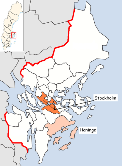
See Haninge kommun on the map
Public Transportation to Haninge kommun
Wondering how to get to Haninge kommun, Sweden? Moovit helps you find the best way to get to Haninge kommun with step-by-step directions from the nearest public transit station.
Moovit provides free maps and live directions to help you navigate through your city. View schedules, routes, timetables, and find out how long does it take to get to Haninge kommun in real time.
Looking for the nearest stop or station to Haninge kommun? Check out this list of stops closest to your destination: Jordbro Station; Jordbro Station Nynäsvägen; Lerstensvägen; Västerhaninge Station; Handen Station.
Bus: 835, 838, 837, 892, 43B, 45B, 827, 842, BÅLSTA STATION - NYNÄSHAMN STATION, 837, 892.Train: BÅLSTA STATION - NYNÄSHAMN STATION, PENDELTÅG, MÄRSTA STATION - NYNÄSHAMN STATION.
Want to see if there’s another route that gets you there at an earlier time? Moovit helps you find alternative routes or times. Get directions from and directions to Haninge kommun easily from the Moovit App or Website.
We make riding to Haninge kommun easy, which is why over 1.5 million users, including users in Haninge, trust Moovit as the best app for public transit. You don’t need to download an individual bus app or train app, Moovit is your all-in-one transit app that helps you find the best bus time or train time available.
For information on prices of bus, train and metro, costs and ride fares to Haninge kommun, please check the Moovit app.
Use the app to navigate to popular places including to the airport, hospital, stadium, grocery store, mall, coffee shop, school, college, and university.
Haninge kommun Address: Hurtigs torg 2 SE-137 64 Jordbro street in Haninge
Attractions near Haninge kommun
Heidarian Restaurang AB,Jordbro Bilblio,Jordbro Sporthall,Hs Pizzeria AB,Jordbro centrum,Cherry,Förskolan Knallen,Ac Miljöteam,Matrix,Hurtigs Torg,Matrix Jordbro,Mely AB,Jordbro Världsorkester,Jordbro,Talaat,C.S.F. Kb,Yarens Pizza,Fusion Diner Haveeli AB,Aimo park,Blommor & Kafé IrinaHow to get to popular attractions in Haninge with public transit
IKEA Gratisbuss, Huddinge,Saltsjöbanan 25 - Slussen - Saltsjöbaden, Stockholm,Downtown Camper By Scandic, Stockholm,Connect Hotel Arlanda, Sigtuna,Enskedehallen, Stockholm,Norra Djurgården, Stockholm,Årsta Havsbad, Haninge,Grimsta IP, Stockholm,Destination GOTLAND Båtbussen mot CITYTERMINALEN, Nynäshamn,Ingarö, Stockholm,Länna, Huddinge,Karlbergs slott, Solna,Saltsjö-Boo, Nacka,Skärholmen, Stockholm,Sophiahemmet, Stockholm,Flygbussarna Torsplan (B), Solna,Akademiska sjukhuset (Ingång 100 / 101), Uppsala,NK - Nordiska Kompaniet, Stockholm,Spår 1 Gävle C, Gävle,Max Martin Villa, EkeröGet around Stockholm by public transit!
Traveling around Stockholm has never been so easy. See step by step directions as you travel to any attraction, street or major public transit station. View bus and train schedules, arrival times, service alerts and detailed routes on a map, so you know exactly how to get to anywhere in Stockholm.
When traveling to any destination around Stockholm use Moovit's Live Directions with Get Off Notifications to know exactly where and how far to walk, how long to wait for your line, and how many stops are left. Moovit will alert you when it's time to get off — no need to constantly re-check whether yours is the next stop.
Wondering how to use public transit in Stockholm or how to pay for public transit in Stockholm? Moovit public transit app can help you navigate your way with public transit easily, and at minimum cost. It includes public transit fees, ticket prices, and costs. Looking for a map of Stockholm public transit lines? Moovit public transit app shows all public transit maps in Stockholm with all Bus, Train, Metro, Light Rail, Ferry and Cable Car routes and stops on an interactive map.
Stockholm has 6 transit type(s), including: Bus, Train, Metro, Light Rail, Ferry and Cable Car, operated by several transit agencies, including SL Tunnelbana, SL Spårvagn, SL Lokalbana, SL Rail, UL, Flygbussarna, Sörmlandstrafiken, X-trafik, Region Gotland, VL, Trosabussen, Vy Bus4You, Bergkvarabuss, Silverlinjen, Y-buss