Directions to Fiskarporten (Gotland) with public transportation
The following transit lines have routes that pass near Fiskarporten
Bus stops near Fiskarporten in Gotland
- Almedalen, 6 min walk,
- Östercentrum, 11 min walk,
- Visby Busstation, 15 min walk,
Bus lines to Fiskarporten in Gotland
- 6, Visby Hamnterminal,
- 6, Almedalen,
- 1, Lasarettet - Visby Pilhagsvägen,
- 2, Sömmerskan - Östercentrum,
- 3, Hyvelgatan - Visby busstation,
- 4, Flundreviken - Visby busstation,
- 5, Lasarettet - Lasarettet,
- 10, Hemse busstation - Visby busstation,
- 12, Burgsvik Stationsvägen - Visby busstation,
- 20, Fårösund färjeläge - Visby busstation,
- 51, Klintehamn Konsum - Visby busstation,
- 61, Lärbro - Visby busstation,
- 62, Salthamn - Visby busstation,
- 1, Visby Pilhagsvägen - Lasarettet,
- 2, Östercentrum - Sömmerskan,
- 3, Visby busstation - Farmek,
- 4, Visby busstation - Flundreviken,
- 10, Burgsvik Stationsvägen - Visby busstation,
- 12, Norrgatt - Burgsvik Stationsvägen,
- 20, Kustparken - Visby busstation,
What are the closest stations to Fiskarporten?
The closest stations to Fiskarporten are:
- Almedalen is 423 meters away, 6 min walk.
- Östercentrum is 768 meters away, 11 min walk.
- Visby Busstation is 1098 meters away, 15 min walk.
Which ferry line stops near Fiskarporten?
DG
What’s the nearest bus stop to Fiskarporten in Gotland?
The nearest bus stop to Fiskarporten in Gotland is Almedalen. It’s a 6 min walk away.
What time is the first bus to Fiskarporten in Gotland?
The 1 is the first bus that goes to Fiskarporten in Gotland. It stops nearby at 5:58 AM.
What time is the last bus to Fiskarporten in Gotland?
The 20 is the last bus that goes to Fiskarporten in Gotland. It stops nearby at 11:25 PM.
See Fiskarporten, Gotland, on the map
Public Transit to Fiskarporten in Gotland
Wondering how to get to Fiskarporten in Gotland, Sweden? Moovit helps you find the best way to get to Fiskarporten with step-by-step directions from the nearest public transit station.
Moovit provides free maps and live directions to help you navigate through your city. View schedules, routes, timetables, and find out how long does it take to get to Fiskarporten in real time.
Looking for the nearest stop or station to Fiskarporten? Check out this list of stops closest to your destination: Almedalen; Östercentrum; Visby Busstation.
Bus: 6, 6, 1, 2, 3, 4, 5, 1, 2, 3, 4, 5, 11, 22, 41, 11, 22, 41.Ferry: DG.
Want to see if there’s another route that gets you there at an earlier time? Moovit helps you find alternative routes or times. Get directions from and directions to Fiskarporten easily from the Moovit App or Website.
We make riding to Fiskarporten easy, which is why over 1.5 million users, including users in Gotland, trust Moovit as the best app for public transit. You don’t need to download an individual bus app or train app, Moovit is your all-in-one transit app that helps you find the best bus time or train time available.
For information on prices of bus and ferry, costs and ride fares to Fiskarporten, please check the Moovit app.
Use the app to navigate to popular places including to the airport, hospital, stadium, grocery store, mall, coffee shop, school, college, and university.
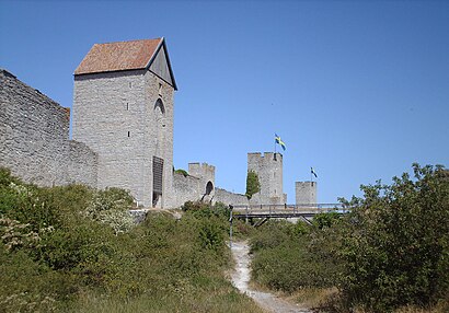
Fiskarporten Address: Fiskarplan street in Gotland
Attractions near Fiskarporten
Best Western Strand Hotel,Almedalen,Solfågel,Hotell Gute,Kärleksporten,Katolska Kyrkan I Visby,Dbw:S Trädgård,Fornsalen,Cramérska Huset,Gotlands Studentkår Rindi,Gotlands Museum,Wisby Strand,Uppsala Universitet,Visby,Gotland County,Bagaren,Donnerska Huset,Donners Plats,Donners Hotel,Vår Fru VisbyHow to get to popular attractions in Gotland with public transit
Kallhäll, Järfälla,Djurgårdsfärjan, Stockholm,Gustav Adolfs Kyrka, Stockholm,Västmanlands sjukhus Västerås, Västerås,Buss 59, Stockholm,Ikea (B), Stockholm,Tåg Sala - Avesta Krylbo, Sala,Villa Källhagen, Stockholm,Västmanlands sjukhus Ingång 2, Västerås,Spår 1-2, Stockholm,Kaninparken i Skarpnäck, Stockholm,Steam Hotel, Västerås,Grand hotell, Stockholm,Flygbussarna Frösundavik (B), Solna,607 Karolinska Sjukhuset - Sollentuna Station - Edsberg - Danderyds Sjh, Solna,Saltsjöbaden, Nacka,Mälarsjukhuset, Eskilstuna,Häggvik, Sollentuna,Fotografiska, Stockholm,Södermalm, StockholmGet around Stockholm by public transit!
Traveling around Stockholm has never been so easy. See step by step directions as you travel to any attraction, street or major public transit station. View bus and train schedules, arrival times, service alerts and detailed routes on a map, so you know exactly how to get to anywhere in Stockholm.
When traveling to any destination around Stockholm use Moovit's Live Directions with Get Off Notifications to know exactly where and how far to walk, how long to wait for your line, and how many stops are left. Moovit will alert you when it's time to get off — no need to constantly re-check whether yours is the next stop.
Wondering how to use public transit in Stockholm or how to pay for public transit in Stockholm? Moovit public transit app can help you navigate your way with public transit easily, and at minimum cost. It includes public transit fees, ticket prices, and costs. Looking for a map of Stockholm public transit lines? Moovit public transit app shows all public transit maps in Stockholm with all Bus, Train, Metro, Light Rail, Ferry and Cable Car routes and stops on an interactive map.
Stockholm has 6 transit type(s), including: Bus, Train, Metro, Light Rail, Ferry and Cable Car, operated by several transit agencies, including SL Tunnelbana, SL Spårvagn, SL Lokalbana, SL Rail, UL, Flygbussarna, Sörmlandstrafiken, X-trafik, Region Gotland, VL, Trosabussen, Vy Bus4You, Bergkvarabuss, Silverlinjen, Y-buss