Directions to Fagersta with public transportation
The following transit lines have routes that pass near Fagersta
How to get to Fagersta by bus?
Click on the bus route to see step by step directions with maps, line arrival times and updated time schedules.
How to get to Fagersta by train?
Click on the train route to see step by step directions with maps, line arrival times and updated time schedules.
Bus stops near Fagersta
- Solliden, 7 min walk,
- Rosenlund, 11 min walk,
Train stations near Fagersta
- Fagersta Norra Station, 32 min walk,
- Fagersta Norra, 32 min walk,
Bus lines to Fagersta
- 83, Lindgården,
- 303, Fagersta Centralstation,
- 82, Risbroplan,
- 82, Virsbo Felingvägen,
What are the closest stations to Fagersta?
The closest stations to Fagersta are:
- Solliden is 450 meters away, 7 min walk.
- Rosenlund is 796 meters away, 11 min walk.
- Fagersta Norra Station is 2466 meters away, 32 min walk.
- Fagersta Norra is 2466 meters away, 32 min walk.
Which bus lines stop near Fagersta?
These bus lines stop near Fagersta: 500, 82.
Which train lines stop near Fagersta?
These train lines stop near Fagersta: 8008, 8034, 8038.
What’s the nearest bus stop to Fagersta?
The nearest bus stop to Fagersta is Solliden. It’s a 7 min walk away.
What time is the first train to Fagersta?
The 8031 is the first train that goes to Fagersta. It stops nearby at 5:08 AM.
What time is the last train to Fagersta?
The 8058 is the last train that goes to Fagersta. It stops nearby at 11:20 PM.
What time is the first bus to Fagersta?
The 303 is the first bus that goes to Fagersta. It stops nearby at 8:26 AM.
What time is the last bus to Fagersta?
The 303 is the last bus that goes to Fagersta. It stops nearby at 3:33 PM.
See Fagersta on the map
Public Transportation to Fagersta
Wondering how to get to Fagersta, Sweden? Moovit helps you find the best way to get to Fagersta with step-by-step directions from the nearest public transit station.
Moovit provides free maps and live directions to help you navigate through your city. View schedules, routes, timetables, and find out how long does it take to get to Fagersta in real time.
Looking for the nearest stop or station to Fagersta? Check out this list of stops closest to your destination: Solliden; Rosenlund; Fagersta Norra Station; Fagersta Norra.
Bus: 500, 82, 83, 303, 83, 303.Train: 8008, 8034, 8038, 8000, 8001, 8004, 8005, 8000, 8001, 8004, 8005.
Want to see if there’s another route that gets you there at an earlier time? Moovit helps you find alternative routes or times. Get directions from and directions to Fagersta easily from the Moovit App or Website.
We make riding to Fagersta easy, which is why over 1.5 million users, including users in Stockholm, trust Moovit as the best app for public transit. You don’t need to download an individual bus app or train app, Moovit is your all-in-one transit app that helps you find the best bus time or train time available.
For information on prices of train and bus, costs and ride fares to Fagersta, please check the Moovit app.
Use the app to navigate to popular places including to the airport, hospital, stadium, grocery store, mall, coffee shop, school, college, and university.
Location: Stockholm
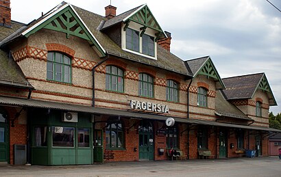
Fagersta is a locality and the seat of Fagersta Municipality in Västmanland County, Sweden, with 11,130 inhabitants in 2010.Wiki
Popular routes to Fagersta
Popular routes from Fagersta
Attractions near Fagersta
Laddningsstation för elbilar,Pay N Charge Nordic,Buddys,Café Stället,Glasögoncentralen,Glasögoncentralen i Västanfors AB,Järnvägsrestaurang & Pub,Fagersta C.,Pricewaterhousecoopers,Swedbank,Bankomat,Nordea,Västanfors bibliotek,Stationsvägen 14 Custom Tattoo,Centralkiosken,Roger Törnqvist Plåt & Isolering,Frimärksombud, Järnvägstorget,Västans Pizzeria,Otoko Sushi,Pizza HaketHow to get to popular attractions in Stockholm with public transit
Brandbergen, Haninge,Saltsjöbaden, Nacka,Västmanlands sjukhus Västerås, Västerås,Friends Arena, Solna,Torsbyfjärden,Buss Grisslehamn - Uppsala, Norrtälje,Hökarängen, Stockholm,Zetas Trädgård, Stockholm,Anstalten Hällby, Eskilstuna,Nya Karolinska Solna, Solna,Stockholms Centralstation, Stockholm,Sparreholm, Flen,Lager 157, Uppsala,Nåttarö, Haninge,Frescati, Stockholm,SL Pendeltåg mot Stockholm, Uppsala,Buss 62, Stockholm,Fjällgatan 44, Stockholm,Ingarö, Värmdö,Folkoperan, StockholmGet around Stockholm by public transit!
Traveling around Stockholm has never been so easy. See step by step directions as you travel to any attraction, street or major public transit station. View bus and train schedules, arrival times, service alerts and detailed routes on a map, so you know exactly how to get to anywhere in Stockholm.
When traveling to any destination around Stockholm use Moovit's Live Directions with Get Off Notifications to know exactly where and how far to walk, how long to wait for your line, and how many stops are left. Moovit will alert you when it's time to get off — no need to constantly re-check whether yours is the next stop.
Wondering how to use public transit in Stockholm or how to pay for public transit in Stockholm? Moovit public transit app can help you navigate your way with public transit easily, and at minimum cost. It includes public transit fees, ticket prices, and costs. Looking for a map of Stockholm public transit lines? Moovit public transit app shows all public transit maps in Stockholm with all Bus, Train, Metro, Light Rail, Ferry and Cable Car routes and stops on an interactive map.
Stockholm has 6 transit type(s), including: Bus, Train, Metro, Light Rail, Ferry and Cable Car, operated by several transit agencies, including SL Tunnelbana, SL Spårvagn, SL Lokalbana, SL Rail, UL, Flygbussarna, Sörmlandstrafiken, X-trafik, Region Gotland, VL, Trosabussen, Vy Bus4You, Bergkvarabuss, Silverlinjen, Y-buss