Directions to Bälinge Kyrka (Uppsala) with public transportation
The following transit lines have routes that pass near Bälinge Kyrka
How to get to Bälinge Kyrka by bus?
Click on the bus route to see step by step directions with maps, line arrival times and updated time schedules.
Bus stops near Bälinge Kyrka in Uppsala
- Bälinge Åkerlänna Vägskäl, 4 min walk,
- Bälinge Lundgården, 4 min walk,
- Bälinge Centrum, 5 min walk,
Bus lines to Bälinge Kyrka in Uppsala
- 105, Bälinge Centrum,
- 168, Isgrena,
- 111, Uppsala Centralstation,
- 111, Bälinge Skola,
- 104, Långåker,
- 104, Skuttunge Skola,
What are the closest stations to Bälinge Kyrka?
The closest stations to Bälinge Kyrka are:
- Bälinge Åkerlänna Vägskäl is 173 meters away, 4 min walk.
- Bälinge Lundgården is 185 meters away, 4 min walk.
- Bälinge Centrum is 281 meters away, 5 min walk.
Which bus lines stop near Bälinge Kyrka?
These bus lines stop near Bälinge Kyrka: 104, 111.
What’s the nearest bus stop to Bälinge Kyrka in Uppsala?
The nearest bus stops to Bälinge Kyrka in Uppsala are Bälinge Åkerlänna Vägskäl and Bälinge Lundgården. The closest one is a 4 min walk away.
What time is the first bus to Bälinge Kyrka in Uppsala?
The 111 is the first bus that goes to Bälinge Kyrka in Uppsala. It stops nearby at 3:00 AM.
What time is the last bus to Bälinge Kyrka in Uppsala?
The 111 is the last bus that goes to Bälinge Kyrka in Uppsala. It stops nearby at 1:01 AM.
How much is the bus fare to Bälinge Kyrka?
The bus fare to Bälinge Kyrka costs about kr27.00 - kr108.00.
See Bälinge Kyrka, Uppsala, on the map
Public Transit to Bälinge Kyrka in Uppsala
Wondering how to get to Bälinge Kyrka in Uppsala, Sweden? Moovit helps you find the best way to get to Bälinge Kyrka with step-by-step directions from the nearest public transit station.
Moovit provides free maps and live directions to help you navigate through your city. View schedules, routes, timetables, and find out how long does it take to get to Bälinge Kyrka in real time.
Looking for the nearest stop or station to Bälinge Kyrka? Check out this list of stops closest to your destination: Bälinge Åkerlänna Vägskäl; Bälinge Lundgården; Bälinge Centrum.
Bus: 104, 111, 105, 105, 168.
Want to see if there’s another route that gets you there at an earlier time? Moovit helps you find alternative routes or times. Get directions from and directions to Bälinge Kyrka easily from the Moovit App or Website.
We make riding to Bälinge Kyrka easy, which is why over 1.5 million users, including users in Uppsala, trust Moovit as the best app for public transit. You don’t need to download an individual bus app or train app, Moovit is your all-in-one transit app that helps you find the best bus time or train time available.
For information on prices of bus, costs and ride fares to Bälinge Kyrka, please check the Moovit app.
Use the app to navigate to popular places including to the airport, hospital, stadium, grocery store, mall, coffee shop, school, college, and university.
Bälinge Kyrka Address: Kyrkbacken street in Uppsala
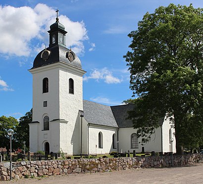
Bälinge Church (Swedish: Bälinge kyrka) is a medieval church in Bälinge, Uppsala Municipality, Sweden. It is part of the Archdiocese of Uppsala (Church of Sweden).Wiki
Attractions near Bälinge Kyrka
Kiplingeberg Godsförvaltning,Bälinge Bygdegård,Segelflygarna,Jumkils skola,Cocks, David,Trädgårdsmart i Sverige AB,Isgrena,Spice & Green,Jan Larssons Åkeri,Bälingebadet,Bälinge,Bälinge Hem och Trädgård AB,Uddens Småbåtshamn Ek.För,Buss 104,Ekeby,Åloppe,Haga,Stall Kjettinge,Forkarby,Thomas Mattsson ByggHow to get to popular attractions in Uppsala with public transit
Stadsgården, Stockholm,Flygbussarna Haga Norra (B), Solna,Vasagatan Centralstationen, Stockholm,Älta, Nacka,Stavsnäs, Värmdö,Radisson Blu Skycity Hotel, Arlanda Airport, Sigtuna,S:t Eriksplan, Stockholm,Arlanda Service Center, Sigtuna,Turkiska Ambassaden, Stockholm,Drottningholm, Ekerö,Radisson Blu Waterfront Hotel, Stockholm,Upplands Väsby, Upplands-Väsby,Flygbussarna Fridhemsplan (B), Stockholm,Junibacken, Stockholm,Scalateatern, Stockholm,Bredden, Upplands-Väsby,Buss 62, Stockholm,Nordiska Museet, Stockholm,Fjärilshuset Haga Ocean, Solna,Spånga, StockholmGet around Stockholm by public transit!
Traveling around Stockholm has never been so easy. See step by step directions as you travel to any attraction, street or major public transit station. View bus and train schedules, arrival times, service alerts and detailed routes on a map, so you know exactly how to get to anywhere in Stockholm.
When traveling to any destination around Stockholm use Moovit's Live Directions with Get Off Notifications to know exactly where and how far to walk, how long to wait for your line, and how many stops are left. Moovit will alert you when it's time to get off — no need to constantly re-check whether yours is the next stop.
Wondering how to use public transit in Stockholm or how to pay for public transit in Stockholm? Moovit public transit app can help you navigate your way with public transit easily, and at minimum cost. It includes public transit fees, ticket prices, and costs. Looking for a map of Stockholm public transit lines? Moovit public transit app shows all public transit maps in Stockholm with all Bus, Train, Metro, Light Rail, Ferry and Cable Car routes and stops on an interactive map.
Stockholm has 6 transit type(s), including: Bus, Train, Metro, Light Rail, Ferry and Cable Car, operated by several transit agencies, including SL Tunnelbana, SL Spårvagn, SL Lokalbana, SL Rail, UL, Flygbussarna, Sörmlandstrafiken, X-trafik, Region Gotland, VL, Trosabussen, Vy Bus4You, Bergkvarabuss, Silverlinjen, Y-buss