Directions to Akalla (Stockholm) with public transportation
The following transit lines have routes that pass near Akalla
How to get to Akalla by bus?
Click on the bus route to see step by step directions with maps, line arrival times and updated time schedules.
How to get to Akalla by train?
Click on the train route to see step by step directions with maps, line arrival times and updated time schedules.
How to get to Akalla by metro?
Click on the metro route to see step by step directions with maps, line arrival times and updated time schedules.
Bus stops near Akalla in Stockholm
- Akalla, 4 min walk,
- Sveaborgsgatan, 6 min walk,
- Trondheimsgatan, 9 min walk,
- Kistahöjden, 14 min walk,
Metro stations near Akalla in Stockholm
- Husby, 10 min walk,
- Tensta, 39 min walk,
Train stations near Akalla in Stockholm
- Helenelund Station, 37 min walk,
Bus lines to Akalla in Stockholm
- 155, Brommaplan,
- 178, Jakobsbergs Station,
- 175, Akalla - Barkarby station,
- 197, Centralen - Sollentuna station,
- 567, Jakobsbergs station - Sollentuna station,
- 517, Kista Centrum,
- 518, Kista Gård,
- 514, Spånga Station,
- 179, Sollentuna station - Vällingby,
- 537, Upplands Väsby station - Kista centrum,
- 612, Arninge station - Kista centrum,
- 685, Åkersberga station - Kista centrum,
- 687, Kista centrum - Blåmesvägen,
What are the closest stations to Akalla?
The closest stations to Akalla are:
- Akalla is 284 meters away, 4 min walk.
- Sveaborgsgatan is 446 meters away, 6 min walk.
- Trondheimsgatan is 685 meters away, 9 min walk.
- Husby is 717 meters away, 10 min walk.
- Kistahöjden is 1027 meters away, 14 min walk.
- Helenelund Station is 2850 meters away, 37 min walk.
- Tensta is 3028 meters away, 39 min walk.
Which bus lines stop near Akalla?
These bus lines stop near Akalla: 178, 514.
Which train lines stop near Akalla?
These train lines stop near Akalla: LINJE 40, LINJE 41.
Which metro line stops near Akalla?
11
What’s the nearest metro station to Akalla in Stockholm?
The nearest metro station to Akalla in Stockholm is Husby. It’s a 10 min walk away.
What’s the nearest bus stop to Akalla in Stockholm?
The nearest bus stop to Akalla in Stockholm is Akalla. It’s a 4 min walk away.
What time is the first metro to Akalla in Stockholm?
The 11 is the first metro that goes to Akalla in Stockholm. It stops nearby at 4:57 AM.
What time is the last metro to Akalla in Stockholm?
The 11 is the last metro that goes to Akalla in Stockholm. It stops nearby at 1:21 AM.
What time is the first train to Akalla in Stockholm?
The LINJE 40 is the first train that goes to Akalla in Stockholm. It stops nearby at 4:21 AM.
What time is the last train to Akalla in Stockholm?
The LINJE 40 is the last train that goes to Akalla in Stockholm. It stops nearby at 1:09 AM.
What time is the first bus to Akalla in Stockholm?
The 197 is the first bus that goes to Akalla in Stockholm. It stops nearby at 3:01 AM.
What time is the last bus to Akalla in Stockholm?
The 197 is the last bus that goes to Akalla in Stockholm. It stops nearby at 3:09 AM.
How much is the light rail fare to Akalla?
The light rail fare to Akalla costs about kr39.00.
How much is the bus fare to Akalla?
The bus fare to Akalla costs about kr39.00.
How much is the metro fare to Akalla?
The metro fare to Akalla costs about kr39.00.
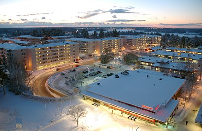
See Akalla, Stockholm, on the map
Public Transit to Akalla in Stockholm
Wondering how to get to Akalla in Stockholm, Sweden? Moovit helps you find the best way to get to Akalla with step-by-step directions from the nearest public transit station.
Moovit provides free maps and live directions to help you navigate through your city. View schedules, routes, timetables, and find out how long does it take to get to Akalla in real time.
Looking for the nearest stop or station to Akalla? Check out this list of stops closest to your destination: Akalla; Sveaborgsgatan; Trondheimsgatan; Husby; Kistahöjden; Helenelund Station; Tensta.
Bus: 178, 514, 155, 175, 197, 567, 517, 518.Train: LINJE 40, LINJE 41, PENDELTÅG, PENDELTÅG, PENDELTÅG.Metro: 11, 10.
Want to see if there’s another route that gets you there at an earlier time? Moovit helps you find alternative routes or times. Get directions from and directions to Akalla easily from the Moovit App or Website.
We make riding to Akalla easy, which is why over 1.5 million users, including users in Stockholm, trust Moovit as the best app for public transit. You don’t need to download an individual bus app or train app, Moovit is your all-in-one transit app that helps you find the best bus time or train time available.
For information on prices of metro, bus, train and light rail, costs and ride fares to Akalla, please check the Moovit app.
Use the app to navigate to popular places including to the airport, hospital, stadium, grocery store, mall, coffee shop, school, college, and university.
Akalla Address: SE-164 78 Sollentuna street in Stockholm
Attractions near Akalla
Parkeringsplats Husby ishall,Vera Beauty Salon,Husby ishall,Husbyhallen,Akalla Mobil Se,Jubba Restaurang,Kulow Abdi Ah,Husbybadet,NOBIL,Ikoni Service & Co,Kista Hockey,Stockholm Parkering,Husbybadet,Akalla moské,Rinkeby Bjj,Sibeliusgången 2,Gokart Prix,Ungdomsstegen AB,Ahmed, Leo,Teba TaxiHow to get to popular attractions in Stockholm with public transit
Ikea-bussen, Stockholm,Flygbussarna S:t Eriksplan (B), Stockholm,Hotel Hasselbacken, Stockholm,Ekeröleden (Ekeröfärjan, Slagstafärjan), Ekerö,Hotel Rival, Stockholm,Hard Rock Café, Stockholm,Vikingterminalen, Stockholm,Malmköping, Flen,Gudrun Sjödén Lagerbutiken Årstaberg, Stockholm,Trons Kapell, Stockholm,Åhléns City, Stockholm,Co 259 Ringen, Stockholm,Vega, Stockholm,2km Loppis, Stockholm,Liljeholmshallen, Stockholm,Grillby, Enköping,Tynningö, Vaxholm,Nåttarö, Haninge,Hotel Birger Jarl, Stockholm,Blidö, NorrtäljeGet around Stockholm by public transit!
Traveling around Stockholm has never been so easy. See step by step directions as you travel to any attraction, street or major public transit station. View bus and train schedules, arrival times, service alerts and detailed routes on a map, so you know exactly how to get to anywhere in Stockholm.
When traveling to any destination around Stockholm use Moovit's Live Directions with Get Off Notifications to know exactly where and how far to walk, how long to wait for your line, and how many stops are left. Moovit will alert you when it's time to get off — no need to constantly re-check whether yours is the next stop.
Wondering how to use public transit in Stockholm or how to pay for public transit in Stockholm? Moovit public transit app can help you navigate your way with public transit easily, and at minimum cost. It includes public transit fees, ticket prices, and costs. Looking for a map of Stockholm public transit lines? Moovit public transit app shows all public transit maps in Stockholm with all Bus, Train, Metro, Light Rail, Ferry and Cable Car routes and stops on an interactive map.
Stockholm has 6 transit type(s), including: Bus, Train, Metro, Light Rail, Ferry and Cable Car, operated by several transit agencies, including SL Tunnelbana, SL Spårvagn, SL Lokalbana, SL Rail, UL, Flygbussarna, Sörmlandstrafiken, X-trafik, Region Gotland, VL, Trosabussen, Vy Bus4You, Bergkvarabuss, Silverlinjen, Y-buss